IMAGES TAKEN NEAR TO
Martindale Road, HOUNSLOW, TW4 7HF
Introduction
This page details the photographs taken nearby to Martindale Road, TW4 7HF by members of the Geograph project.
The Geograph project started in 2005 with the aim of publishing, organising and preserving representative images for every square kilometre of Great Britain, Ireland and the Isle of Man.

There are currently over 7.5m images from over14,400 individuals and you can help contribute to the project by visiting https://www.geograph.org.uk
Image Map
Images are licensed for reuse under creativecommons.org/licenses/by-sa/2.0
Notes
- Clicking on the map will re-center to the selected point.
- The higher the marker number, the further away the image location is from the centre of the postcode.
Image Listing (47 Images Found)
Images are licensed for reuse under creativecommons.org/licenses/by-sa/2.0
Image
Details
Distance
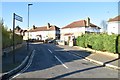
9
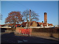
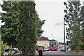
Hounslow Heath Infant and Nursery School
The main geographical feature of this square is the old cavalry barracks in Beavers Lane but they were not keen on a photograph being taken. Nearby at the junction of Beaver Lane and Martindale Road is this infant school.
Image: © David Squire
Taken: 11 Jan 2006
0.10 miles