IMAGES TAKEN NEAR TO
Bowness Drive, HOUNSLOW, TW4 7BL
Introduction
This page details the photographs taken nearby to Bowness Drive, TW4 7BL by members of the Geograph project.
The Geograph project started in 2005 with the aim of publishing, organising and preserving representative images for every square kilometre of Great Britain, Ireland and the Isle of Man.

There are currently over 7.5m images from over14,400 individuals and you can help contribute to the project by visiting https://www.geograph.org.uk
Image Map
Images are licensed for reuse under creativecommons.org/licenses/by-sa/2.0
Notes
- Clicking on the map will re-center to the selected point.
- The higher the marker number, the further away the image location is from the centre of the postcode.
Image Listing (35 Images Found)
Images are licensed for reuse under creativecommons.org/licenses/by-sa/2.0
Image
Details
Distance
1
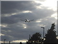
Plane over Cambridge Road, Hounslow
This is on the regular flight path to Heathrow and has a few planes per minute in constant streams until they change the pattern.
Image: © David Howard
Taken: 16 Aug 2014
0.06 miles
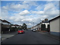
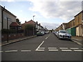
2
Selwyn Close, Hounslow
Looking towards Hounslow Heath School
Image: © David Howard
Taken: 16 Aug 2014
0.08 miles
3
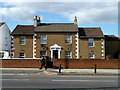
House for sale, Staines Road
It has a most ornate doorway, but seems to be just an ordinary small house, apparently extended.
Image: © Robin Webster
Taken: 14 Sep 2012
0.10 miles
4
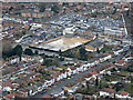
Hounslow West from the air
The site of the demolished Morrisons supermarket is prominent, with Hounslow West tube station beyond. In December 2017 Hounslow Council approved the demolition of the supermarket and construction of four buildings up to six storeys containing 176 affordable housing residential units and 815 sq.m. of retail floorspace.
See the scene in March 2014 Image
Image: © Thomas Nugent
Taken: 28 Feb 2019
0.10 miles
5
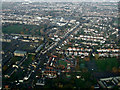
Hounslow from the air
Martindale Road is prominent, Hounslow Barracks are on the left.
See also Image
Image: © Thomas Nugent
Taken: 24 Nov 2014
0.10 miles
6
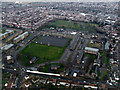
Cavalry Barracks, Hounslow from the air
Long established army barracks in West Hounslow http://en.wikipedia.org/wiki/Cavalry_Barracks,_Hounslow .
Image: © Thomas Nugent
Taken: 16 Feb 2015
0.10 miles
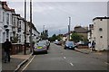
7
Clare Road at the junction of Cambridge Road
Image: © David Howard
Taken: 16 Aug 2014
0.11 miles
8
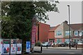
Petrol station on Staines Road, Hounslow
Image: © David Howard
Taken: 12 Aug 2018
0.11 miles