IMAGES TAKEN NEAR TO
Cromwell Road, HOUNSLOW, TW3 3QJ
Introduction
This page details the photographs taken nearby to Cromwell Road, TW3 3QJ by members of the Geograph project.
The Geograph project started in 2005 with the aim of publishing, organising and preserving representative images for every square kilometre of Great Britain, Ireland and the Isle of Man.

There are currently over 7.5m images from over14,400 individuals and you can help contribute to the project by visiting https://www.geograph.org.uk
Image Map
Images are licensed for reuse under creativecommons.org/licenses/by-sa/2.0
Notes
- Clicking on the map will re-center to the selected point.
- The higher the marker number, the further away the image location is from the centre of the postcode.
Image Listing (8 Images Found)
Images are licensed for reuse under creativecommons.org/licenses/by-sa/2.0
Image
Details
Distance
3
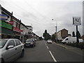
Shops on Wellington Road South, Hounslow
The African Queen Bar is on the right
Image: © David Howard
Taken: 17 Aug 2013
0.19 miles
5
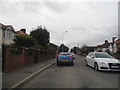
Wellington Road South, Hounslow
The road surface does not normally look like this, it is prepared to be resurfaced.
Image: © David Howard
Taken: 17 Aug 2013
0.22 miles
6
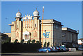
Gurdwara Sri Guru Singh Sabha
A Sikh Temple. There is a temple with the same name in Southall and nearly all information seems to be about that one. I can't even find when this one was built.
Image: © Des Blenkinsopp
Taken: 8 Jan 2019
0.23 miles
7

Hanworth from the air
The A314, on approach to the south runway at Heathrow from the east.
Image: © Thomas Nugent
Taken: 19 Jun 2015
0.24 miles
