1
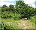
Fox sculpture, Mereway Nature Park
This sculpture is by Paul Siwell http://thecarvedtree.com/default.htm who specialises in carving felled or dead trees into sculptures. See
Image for a view of the wild area around it.
Image: © David Hawgood
Taken: 24 Jul 2010
0.05 miles
2
Mereway Nature Park with sculpture
This is Mereway Nature Park, just east of Kneller Gardens. The area used to be allotments, became overgrown with scrub, and is being maintained in a rather wild state as a park. It has a walk and new cycleway beside the Crane, and it also has this sculpture of a fox on a bench. See Friends of the River Crane Environment https://www.force.org.uk/ . See
Image for close view of the sculpture.
Image: © David Hawgood
Taken: 24 Jul 2010
0.05 miles
3
Open space with a wooden fox, off the River Crane Walk
Formerly allotments.
Image: © Christine Johnstone
Taken: 21 Apr 2015
0.06 miles
4
Pipe bridge on the south side of the railway, Twickenham
Crossing the old access road to the council depot, now the River Crane Way.
Image: © Christine Johnstone
Taken: 21 Apr 2015
0.07 miles
5
New cycle bridge through Kneller Gardens
Previously there was only a narrow footbridge here over the River Crane. The new bridge links the Crane River cycleway through to Twickenham Stoop rugby stadium, Richmond upon Thames College, and Whitton Station.
Image: © David Hawgood
Taken: 24 Jul 2010
0.07 miles
6
Weir on River Crane
At the near left is the junction with the Duke of Northumberland's River, which appears to take most of the flow towards the Thames when levels are fairly low.
Image: © Robin Webster
Taken: 14 Sep 2012
0.08 miles
7
Road with setts and stone flags, Twickenham
Designed for horse-drawn carts. Heading under the railway line to the council depot, which was originally built by Twickenham Urban District Council.
Image: © Christine Johnstone
Taken: 21 Apr 2015
0.08 miles
8
Bridge on Waterloo to Wokingham Junction line
This rather small underpass was formerly the only access to the Twickenham Corporation sewage works, which was behind the camera. The works site is now a rubbish collection services depot, with rather better access from the north.
Image: © Robin Webster
Taken: 14 Sep 2012
0.08 miles
9
Footbridge over Duke of Northumberland's River
Connecting Kneller Gardens on the left to what used to be an area of allotments, now Mereway Nature Park.
Image: © Robin Webster
Taken: 14 Sep 2012
0.08 miles
10
Perimeter path, Kneller Gardens
At the corner is a fenced wildflower area.
Image: © Christine Johnstone
Taken: 21 Apr 2015
0.09 miles


