
IMAGES TAKEN NEAR TO
Ryecroft Avenue, TWICKENHAM, TW2 6HQ
Introduction
This page details the photographs taken nearby to Ryecroft Avenue, TW2 6HQ by members of the Geograph project.
The Geograph project started in 2005 with the aim of publishing, organising and preserving representative images for every square kilometre of Great Britain, Ireland and the Isle of Man.

There are currently over 7.5m images from over14,400 individuals and you can help contribute to the project by visiting https://www.geograph.org.uk
Image Map
Images are licensed for reuse under creativecommons.org/licenses/by-sa/2.0
Notes
- Clicking on the map will re-center to the selected point.
- The higher the marker number, the further away the image location is from the centre of the postcode.
Image Listing (15 Images Found)
Images are licensed for reuse under creativecommons.org/licenses/by-sa/2.0
Image
Details
Distance
1
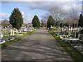
Twickenham Cemetery
Twickenham Cemetery off Hospital Bridge Road
Image: © Shaun Ferguson
Taken: 15 Feb 2013
0.17 miles
3
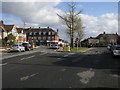
Montrose Avenue
Montrose Avenue at junction with Percy Road
Image: © Shaun Ferguson
Taken: 15 Feb 2013
0.20 miles
5
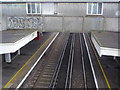
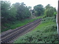
Bridge over railway lines, Whitton station
Image: © David Howard
Taken: 25 May 2008
0.22 miles
9
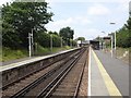
Whitton railway station, Greater London
Opened in 1930 by the Southern Railway on its line from Richmond to Staines.
View west towards Feltham and Staines. Lifts were added to the footbridge, and the eastbound platform shelter was extended in 2016.
Image: © Nigel Thompson
Taken: 8 Jul 2019
0.24 miles
10
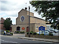
Roman Catholic church, Whitton
St. Edmund of Canterbury. St. Edmund's Catholic Primary School is accessed to the right and is mostly behind the church.
Image: © Robin Webster
Taken: 14 Sep 2012
0.24 miles