IMAGES TAKEN NEAR TO
Hawksway, STAINES-UPON-THAMES, TW18 4RY
Introduction
This page details the photographs taken nearby to Hawksway, TW18 4RY by members of the Geograph project.
The Geograph project started in 2005 with the aim of publishing, organising and preserving representative images for every square kilometre of Great Britain, Ireland and the Isle of Man.

There are currently over 7.5m images from over14,400 individuals and you can help contribute to the project by visiting https://www.geograph.org.uk
Image Map
Images are licensed for reuse under creativecommons.org/licenses/by-sa/2.0
Notes
- Clicking on the map will re-center to the selected point.
- The higher the marker number, the further away the image location is from the centre of the postcode.
Image Listing (69 Images Found)
Images are licensed for reuse under creativecommons.org/licenses/by-sa/2.0
Image
Details
Distance
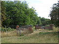
1
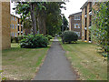
Footpath from Waters Drive
This footpath from Waters Drive, in Staines-upon-Thames, leads to a small industrial estate at Mill Mead. This is on the route of The Freedom Trail long-distance path.
Image: © Sean Davis
Taken: 19 Apr 2013
0.10 miles
3
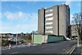
Telephone exchange, Staines
On Fairfield Avenue.
Image: © Robin Webster
Taken: 17 Jan 2015
0.11 miles
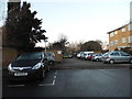
4
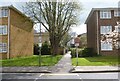
Moormede Estate, Staines
1970s flats and walkway in the Moormede Estate.
Image: © Alan Hunt
Taken: 13 Aug 2013
0.11 miles
5
Disused bridge
A disused bridge over the Staines reservoirs aqueduct. The site of the BEA Trident crash in 1972 is in the meadow on the other side of the bridge.
Image: © Alan Hunt
Taken: 13 Aug 2013
0.13 miles
6
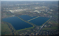
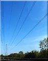
Staines reservoirs from the air
With Staines in the foreground and Stanwell and Heathrow Airport beyond the reservoirs.
Image: © Thomas Nugent
Taken: 19 Jan 2020
0.13 miles
8
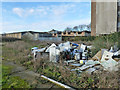
Rubbish on vacant site, Fairfield Avenue, Staines
Now built on - the site, not the rubbish.
Image: © Robin Webster
Taken: 17 Jan 2015
0.14 miles
9
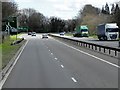
Staines Bypass, Approaching The Crooked Billet
The Crooked Billet is an example of a “hamburger” junction http://www.sabre-roads.org.uk/wiki/index.php?title=Hamburger_Junction . It looks like a roundabout, except that the A308 passes through the middle on the flat, the whole controlled by traffic lights.
Image: © David Dixon
Taken: 11 Apr 2015
0.14 miles
10
Waters Drive at the junction of Kingfisher Drive, Staines
Image: © David Howard
Taken: 18 Jan 2015
0.14 miles