IMAGES TAKEN NEAR TO
Thorpeside Close, STAINES-UPON-THAMES, TW18 3NZ
Introduction
This page details the photographs taken nearby to Thorpeside Close, TW18 3NZ by members of the Geograph project.
The Geograph project started in 2005 with the aim of publishing, organising and preserving representative images for every square kilometre of Great Britain, Ireland and the Isle of Man.

There are currently over 7.5m images from over14,400 individuals and you can help contribute to the project by visiting https://www.geograph.org.uk
Image Map
Images are licensed for reuse under creativecommons.org/licenses/by-sa/2.0
Notes
- Clicking on the map will re-center to the selected point.
- The higher the marker number, the further away the image location is from the centre of the postcode.
Image Listing (10 Images Found)
Images are licensed for reuse under creativecommons.org/licenses/by-sa/2.0
Image
Details
Distance
1
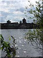
Riverside just north of Laleham
This is the west side of the Thames at the bend between Staines and Penton Hook island
Image: © steve
Taken: 14 Aug 2005
0.08 miles
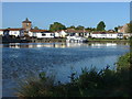
2
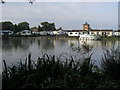
River Thames
River Thames looking across to Fishing Temple
Image: © Shaun Ferguson
Taken: 9 Oct 2012
0.19 miles
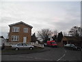
3
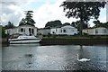
Mobile home site at Staines
On the south side of the river on the long bend south of Staines is a small mobile home site with these houses having the best view over the water.
Image: © Graham Horn
Taken: 24 Aug 2008
0.21 miles
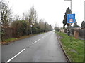
5
Chertsey Lane at the junction of Weir Place
The old border between Staines and Egham was the Thames, since Surrey extended north of the river in 1965 when Middlesex was abolished as a county the border drifted the other side.
Image: © David Howard
Taken: 14 Dec 2014
0.22 miles
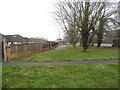
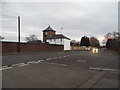
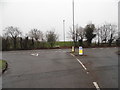
6
Aymer Drive at the junction of Weir Place, Egham
Image: © David Howard
Taken: 14 Dec 2014
0.22 miles
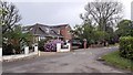
9
Norlands Lane at the junction of Chertsey Lane
Image: © David Howard
Taken: 13 Dec 2015
0.24 miles
10
The Thames near Penton Hook
Looking across the Thames towards the Fishing Temple Park Homes, a mobile home development on Chertsey Lane.
Image: © Alan Hunt
Taken: 4 Oct 2012
0.24 miles