
IMAGES TAKEN NEAR TO
Thames Side, STAINES-UPON-THAMES, TW18 2JH
Introduction
This page details the photographs taken nearby to Thames Side, TW18 2JH by members of the Geograph project.
The Geograph project started in 2005 with the aim of publishing, organising and preserving representative images for every square kilometre of Great Britain, Ireland and the Isle of Man.

There are currently over 7.5m images from over14,400 individuals and you can help contribute to the project by visiting https://www.geograph.org.uk
Image Map
Images are licensed for reuse under creativecommons.org/licenses/by-sa/2.0
Notes
- Clicking on the map will re-center to the selected point.
- The higher the marker number, the further away the image location is from the centre of the postcode.
Image Listing (59 Images Found)
Images are licensed for reuse under creativecommons.org/licenses/by-sa/2.0
Image
Details
Distance
2
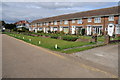
Houses near Penton Hook
Houses probably from the early 1970s overlooking the River Thames near Penton Hook.
Image: © Philip Halling
Taken: 29 Aug 2011
0.05 miles
3

Thames side terrace by the Thames Path
Image: © Philip Jeffrey
Taken: 31 Aug 2025
0.05 miles
4
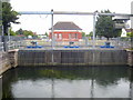
Laleham raw water intake
This intake extracts water from the Thames to feed the Queen Mary Reservoir.
Image: © Rod Allday
Taken: 22 Jun 2011
0.06 miles
5
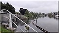
River Thames - Thames Water Inlet for the Queen Mary Reservoir
Image: © James Emmans
Taken: 11 May 2016
0.06 miles
6
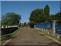
Thameside, Penton Hook
The road bridge over the uptake cut that supplies the Queen Mary reservoir just over 1Km from the Thames. The meter house to measure the amount of water uplifted is behind the blue fence.
Image: © Alan Hunt
Taken: 4 Oct 2012
0.06 miles
8
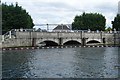
Municipal waterworks
This is part of the vast water supply system in the area. This is an outlet from the Queen Mary Reservoir, presumably provided as an overflow channel as the reservoir is higher. The inscription MWG 1824, is unusual though; this predates the reservoir suggesting a different purpose.
Image: © Graham Horn
Taken: 24 Aug 2008
0.06 miles
9
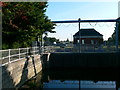
Raw Water Intake for Thames Water at Laleham
Takes water from the Thames for the Queen Mary Reservoir.
Image: © Eirian Evans
Taken: 14 Oct 2011
0.06 miles
10
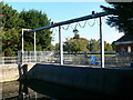
Thames Water Raw Water Intake, Laleham
Takes water from the Thames for the Queen Mary Reservoir.
Image: © Eirian Evans
Taken: 14 Oct 2011
0.06 miles