Municipal waterworks
Introduction
The photograph on this page of Municipal waterworks by Graham Horn as part of the Geograph project.
The Geograph project started in 2005 with the aim of publishing, organising and preserving representative images for every square kilometre of Great Britain, Ireland and the Isle of Man.

There are currently over 7.5m images from over 14,400 individuals and you can help contribute to the project by visiting https://www.geograph.org.uk
Municipal waterworks
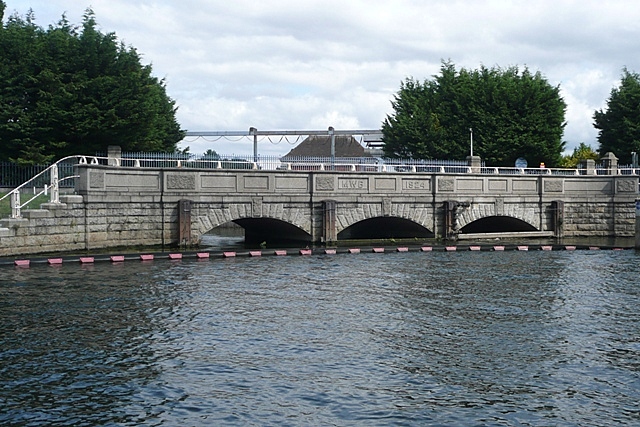
Image: © Graham Horn Taken: 24 Aug 2008
This is part of the vast water supply system in the area. This is an outlet from the Queen Mary Reservoir, presumably provided as an overflow channel as the reservoir is higher. The inscription MWG 1824, is unusual though; this predates the reservoir suggesting a different purpose.
Images are licensed for reuse under creativecommons.org/licenses/by-sa/2.0
Image Location


Leaflet Map data © OpenStreetMap
Latitude
51.413131
Longitude
-0.494161