IMAGES TAKEN NEAR TO
Nursery Road, SUNBURY-ON-THAMES, TW16 6LW
Introduction
This page details the photographs taken nearby to Nursery Road, TW16 6LW by members of the Geograph project.
The Geograph project started in 2005 with the aim of publishing, organising and preserving representative images for every square kilometre of Great Britain, Ireland and the Isle of Man.

There are currently over 7.5m images from over14,400 individuals and you can help contribute to the project by visiting https://www.geograph.org.uk
Image Map
Images are licensed for reuse under creativecommons.org/licenses/by-sa/2.0
Notes
- Clicking on the map will re-center to the selected point.
- The higher the marker number, the further away the image location is from the centre of the postcode.
Image Listing (44 Images Found)
Images are licensed for reuse under creativecommons.org/licenses/by-sa/2.0
Image
Details
Distance
2
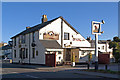
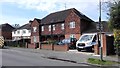
The Grizzly Bear
A pub on Nursery Road, dating from at least 1861 when it was known as The Jolly Gardeners. It was renamed The Clare Tavern, before receiving its present name in 2004.
Image: © Ian Capper
Taken: 10 Nov 2010
0.05 miles
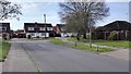
3
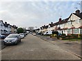
Evelyn Crescent
View north from close to Nursery Road.
Image: © James Emmans
Taken: 8 Apr 2020
0.05 miles
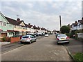
4
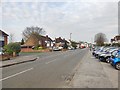
Nursery Road close to Stratton Road
A busy road in Sunbury towards the Upper Halliford Road.
Image: © James Emmans
Taken: 8 Apr 2020
0.06 miles
6
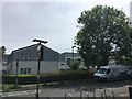
North east part of Peregrine Road
Relatively prettily designed apartments, some are socially rented and landscaping outlay is reasonable. Crossing the main road gives a short pleasant walk under the flyover bridge to Upper Halliford station. The zone is stubbornly outside of Zone 6 in transport.
Image: © Ad-lad
Taken: 8 May 2020
0.09 miles
8
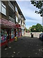
Peregrine Road groceries, salon, clothes cleaning (three shops)
This parade is supplemented by another about two hundred metres east. The other has a restaurant and pharmacy and similar grocery store among other outlets.
Image: © Ad-lad
Taken: 8 May 2020
0.10 miles
9
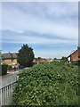
Laytons Lane from south end
From the residual horse fields which are Green Belt in Sunbury.
Image: © Ad-lad
Taken: 8 May 2020
0.10 miles