IMAGES TAKEN NEAR TO
Ashford Road, ASHFORD, TW15 1PA
Introduction
This page details the photographs taken nearby to Ashford Road, TW15 1PA by members of the Geograph project.
The Geograph project started in 2005 with the aim of publishing, organising and preserving representative images for every square kilometre of Great Britain, Ireland and the Isle of Man.

There are currently over 7.5m images from over14,400 individuals and you can help contribute to the project by visiting https://www.geograph.org.uk
Image Map (Loading...)


Getting Data...Please wait
Leaflet Map data © OpenStreetMap
Images are licensed for reuse under creativecommons.org/licenses/by-sa/2.0
Notes
- Clicking on the map will re-center to the selected point.
- The higher the marker number, the further away the image location is from the centre of the postcode.
Image Listing (10 Images Found)
Images are licensed for reuse under creativecommons.org/licenses/by-sa/2.0
Image
Details
Distance
1
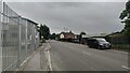
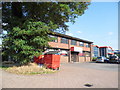
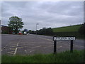
Ashford Road
Close to the roundabout going towards Carlton.
Image: © James Emmans
Taken: 15 Aug 2021
0.02 miles
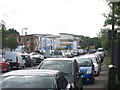
2
Ashford Road, Charlton
Looking towards the industrial estate, with the reservoir on the left.
Image: © David Howard
Taken: 26 Aug 2013
0.03 miles
4
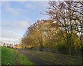
Track leading to water works
Part of this grid-square is occupied by the eastern side of Queen Mary Reservoir, while much of the rest falls within the boundary of Ashford Common Advanced Water Treatment Works. The track shown here gives access to the works from the west - from Charlton Road - though the lack of tarmac would suggest that it is not often used.
There is no routine public access, and this shot was taken through the bars of a gate. Satellite imagery shows that the area to the left (north) of the track is occupied by filter beds.
Image: © Stefan Czapski
Taken: 6 Dec 2013
0.16 miles
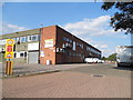
5
Thames House on Littleton industrial estate
Image: © David Howard
Taken: 26 Aug 2013
0.18 miles
7
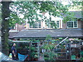
Shop in Charlton Village
This is the general store in Charlton Village between the Queen Mary reservoir and the M3
Image: © steve
Taken: 9 Aug 2005
0.19 miles
9
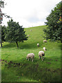
Charlton Road from the corner of Littleton Road
The verges are round the edge of Queen Mary Reservoir, and normally occupied by sheep
Image: © David Howard
Taken: 9 Jun 2013
0.23 miles
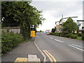
10
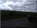
Ashford Road from the corner of Littleton Road
The grass is the edge of the Queen Mary Reservoir, and the verges are normally occupied by sheep.
Image: © David Howard
Taken: 9 Jun 2013
0.24 miles