IMAGES TAKEN NEAR TO
Stanwell Road, FELTHAM, TW14 8NG
Introduction
This page details the photographs taken nearby to Stanwell Road, TW14 8NG by members of the Geograph project.
The Geograph project started in 2005 with the aim of publishing, organising and preserving representative images for every square kilometre of Great Britain, Ireland and the Isle of Man.

There are currently over 7.5m images from over14,400 individuals and you can help contribute to the project by visiting https://www.geograph.org.uk
Image Map
Images are licensed for reuse under creativecommons.org/licenses/by-sa/2.0
Notes
- Clicking on the map will re-center to the selected point.
- The higher the marker number, the further away the image location is from the centre of the postcode.
Image Listing (23 Images Found)
Images are licensed for reuse under creativecommons.org/licenses/by-sa/2.0
Image
Details
Distance
2
Rolls Royce warehouse near Heathrow Airport
Image: © James Emmans
Taken: 2 Jan 2017
0.08 miles
5
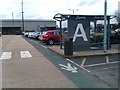
Bus Stop A, Heathrow Terminal 4 Business Parking
Image: © David Martin
Taken: 30 Mar 2013
0.11 miles
6
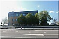
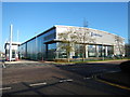
Merck offices on Great Southwest Road, Feltham
Image: © David Howard
Taken: 25 Apr 2021
0.11 miles
7
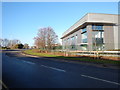
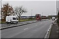
Scylla Road
Small Industrial Road near Longford River with business units.
Image: © James Emmans
Taken: 2 Jan 2017
0.12 miles
9

Twin Rivers seen from Scylla Road
On the right is the Longford River and to the left, slightly hidden, is The Duke of Northumberland's River. To the south of Heathrow Airport and its Southern Perimeter Road, the two waterways run parallel and it is possible to follow a track between them. Here they are known as the Twin Rivers.
Charles I ordered the construction of the totally artificial watercourse known as the Longford River to carry water from the River Colne to the water features in Bushy Park and then on to the Long Water in Home Park at Hampton Court. The Longford River opened in 1638.
This western section of the Duke of Northumberland's River was constructed during the reign of King Henry VIIIth. It takes water from the River Colne and was designed to supplement the flow to existing mills.
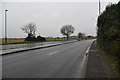
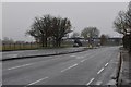
The Southern Perimeter Road is above the bank to the left and Stanwell Road is beyond the Longford River to the right.
Image: © Marathon
Taken: 10 Sep 2014
0.15 miles
10

Twin Rivers seen from Scylla Road
On the left is the Longford River and to the right, slightly hidden, is The Duke of Northumberland's River. To the south of Heathrow Airport and its Southern Perimeter Road, the two waterways run parallel and it is possible to follow a track between them. Here they are known as the Twin Rivers.
Charles I ordered the construction of the totally artificial watercourse known as the Longford River to carry water from the River Colne to the water features in Bushy Park and then on to the Long Water in Home Park at Hampton Court. The Longford River opened in 1638.
This western section of the Duke of Northumberland's River was constructed during the reign of King Henry VIIIth. It takes water from the River Colne and was designed to supplement the flow to existing mills.
The Southern Perimeter Road is above the bank to the right and Stanwell Road is beyond the trees to the left. The lamp posts of both roads can be seen.
Image: © Marathon
Taken: 10 Sep 2014
0.16 miles