IMAGES TAKEN NEAR TO
Lebanon Avenue, FELTHAM, TW13 6RS
Introduction
This page details the photographs taken nearby to Lebanon Avenue, TW13 6RS by members of the Geograph project.
The Geograph project started in 2005 with the aim of publishing, organising and preserving representative images for every square kilometre of Great Britain, Ireland and the Isle of Man.

There are currently over 7.5m images from over14,400 individuals and you can help contribute to the project by visiting https://www.geograph.org.uk
Image Map
Images are licensed for reuse under creativecommons.org/licenses/by-sa/2.0
Notes
- Clicking on the map will re-center to the selected point.
- The higher the marker number, the further away the image location is from the centre of the postcode.
Image Listing (38 Images Found)
Images are licensed for reuse under creativecommons.org/licenses/by-sa/2.0
Image
Details
Distance
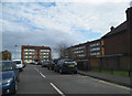
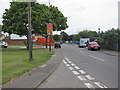
5
Church Road
Church Road down to the then closed footbridge over the A316
Image: © Shaun Ferguson
Taken: 15 Feb 2013
0.12 miles
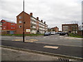
7
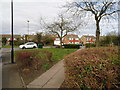
Nallhead Road from the corner of Dickenson Road
Image: © David Howard
Taken: 14 Apr 2013
0.13 miles
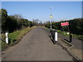
8
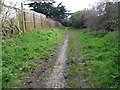
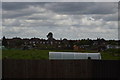
Bridle path from Hanworth to Kempton Park
Image: © David Howard
Taken: 14 Apr 2013
0.14 miles
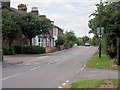
9
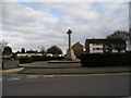
War memorial on Main Street, Hanworth
This is the least like any Main Street I have ever come across
Image: © David Howard
Taken: 14 Apr 2013
0.16 miles