IMAGES TAKEN NEAR TO
Cranmer Road, HAMPTON, TW12 1DW
Introduction
This page details the photographs taken nearby to Cranmer Road, TW12 1DW by members of the Geograph project.
The Geograph project started in 2005 with the aim of publishing, organising and preserving representative images for every square kilometre of Great Britain, Ireland and the Isle of Man.

There are currently over 7.5m images from over14,400 individuals and you can help contribute to the project by visiting https://www.geograph.org.uk
Image Map
Images are licensed for reuse under creativecommons.org/licenses/by-sa/2.0
Notes
- Clicking on the map will re-center to the selected point.
- The higher the marker number, the further away the image location is from the centre of the postcode.
Image Listing (67 Images Found)
Images are licensed for reuse under creativecommons.org/licenses/by-sa/2.0
Image
Details
Distance
4
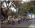
ATC Band, St. James' Road, Hampton, 1971
This is the band of No. 267 Squadron, Air Training Corps leading a parade along Saint James' Road, Hampton Hill in 1971. I cannot remember the exact event. The Officer on the left is Gordon Tims.
Image: © Stephen Williams
Taken: Unknown
0.07 miles
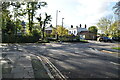
7
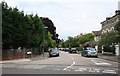
Uxbridge Road at the junction of Windmill Road
Image: © David Howard
Taken: 29 Jun 2014
0.11 miles
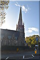
10

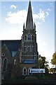
St James, St James Road, Hampton Hill - Stained glass window
Image: © John Salmon
Taken: 13 Jul 2011
0.11 miles