IMAGES TAKEN NEAR TO
Station Road, TEDDINGTON, TW11 9AD
Introduction
This page details the photographs taken nearby to Station Road, TW11 9AD by members of the Geograph project.
The Geograph project started in 2005 with the aim of publishing, organising and preserving representative images for every square kilometre of Great Britain, Ireland and the Isle of Man.

There are currently over 7.5m images from over14,400 individuals and you can help contribute to the project by visiting https://www.geograph.org.uk
Image Map
Images are licensed for reuse under creativecommons.org/licenses/by-sa/2.0
Notes
- Clicking on the map will re-center to the selected point.
- The higher the marker number, the further away the image location is from the centre of the postcode.
Image Listing (136 Images Found)
Images are licensed for reuse under creativecommons.org/licenses/by-sa/2.0
Image
Details
Distance
1
The Travelodge on Station Road, Teddington
Image: © David Howard
Taken: 29 Jun 2014
0.02 miles
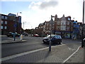
3
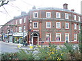
Teddington NatWest
This large bank, with its curved brick facade, dominates the corner of High Street and Station Road, Teddington.
Image: © Colin Smith
Taken: 22 Feb 2009
0.03 miles
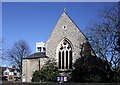
4
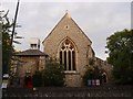
Christ Church
Christ Church, Teddington
Image: © Graeme Smith
Taken: 2 Jul 2011
0.03 miles
5
Park Road, junction with Broad Street, Teddington
Image: © Stacey Harris
Taken: 16 Oct 2010
0.04 miles
6
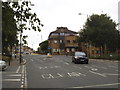
High Street Teddington
By the junction of Waldegrave Road
Image: © David Howard
Taken: 29 Jun 2014
0.04 miles
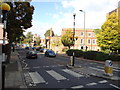
9
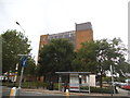
Office block on High Street, Teddington
Image: © David Howard
Taken: 29 Jun 2014
0.06 miles
10
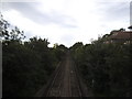
The railway line from High Street Teddington
Image: © David Howard
Taken: 29 Jun 2014
0.06 miles