IMAGES TAKEN NEAR TO
Somerset Gardens, TEDDINGTON, TW11 8TA

Introduction

This page details the photographs taken nearby to Somerset Gardens, TW11 8TA by members of the Geograph project.

The Geograph project started in 2005 with the aim of publishing, organising and preserving representative images for every square kilometre of Great Britain, Ireland and the Isle of Man.

There are currently over 7.5m images from over14,400 individuals and you can help contribute to the project by visiting https://www.geograph.org.uk

Image Map


Images are licensed for reuse under creativecommons.org/licenses/by-sa/2.0
Notes
  • Clicking on the map will re-center to the selected point.
  • The higher the marker number, the further away the image location is from the centre of the postcode.

Image Listing (37 Images Found)

Images are licensed for reuse under creativecommons.org/licenses/by-sa/2.0
  • ...
Image
Details
Distance
1
Elm Tree Road, Teddington.
Houses in Elm Tree Road looking NW. The large building on the right was once Grundy's, a metal-bashing factory making catering equipment and suchlike. Needless to say that has now closed, and not long after this was taken it became a Citroen service centre.
Image: © Stephen Williams Taken: Unknown
0.06 miles
2
Stanley Gardens Road, Teddington
Houses in Stanley Gardens Road, Teddington (TW11 8SY). Number 59 is in the foreground, numbers 45 to 57 also visible.
Image: © Stephen Williams Taken: Unknown
0.09 miles
3
Stanley Road
Gloucester Road leaves to the left.
Image: © Robin Webster Taken: 16 Sep 2012
0.11 miles
4
Ss Peter and Paul Church, Teddington
Image: © steve Taken: 15 Jun 2005
0.11 miles
5
Stanley Road
Image: © Oast House Archive Taken: 22 Jun 2014
0.13 miles
6
Teddington - Large Victorian House in Gloucester Road
Image: © James Emmans Taken: 28 Aug 2016
0.15 miles
7
Footbridge over the railway
Between Linden Grove and Somerset Road
Image: © David Howard Taken: 2 Aug 2009
0.16 miles
8
Railway line by Linden Road, Teddington
From the footbridge
Image: © David Howard Taken: 2 Aug 2009
0.16 miles
9
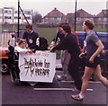
Pram Race, Church Road Teddington 1986
This was one of the entrants in a fund raising pram race in April or May 1986. I have submitted this picture as it shows the school field and houses behind. This field was once an estate of Victorian terraced houses until the whole area was devastated by a Nazi V-2 rocket in 1945. Post war the area was only partly redeveloped, the bulk becoming a school playing field. The rooves of the semi-detached houses in the background still show signs of repair work carried out after the bombing.
Image: © Stephen Williams Taken: Unknown
0.17 miles
10
York Road, Fulwell (south side)
Image: © David Kemp Taken: 8 Nov 2016
0.17 miles
  • ...