IMAGES TAKEN NEAR TO
Beaufort Road, RICHMOND, TW10 7XS
Introduction
This page details the photographs taken nearby to Beaufort Road, TW10 7XS by members of the Geograph project.
The Geograph project started in 2005 with the aim of publishing, organising and preserving representative images for every square kilometre of Great Britain, Ireland and the Isle of Man.

There are currently over 7.5m images from over14,400 individuals and you can help contribute to the project by visiting https://www.geograph.org.uk
Image Map
Images are licensed for reuse under creativecommons.org/licenses/by-sa/2.0
Notes
- Clicking on the map will re-center to the selected point.
- The higher the marker number, the further away the image location is from the centre of the postcode.
Image Listing (131 Images Found)
Images are licensed for reuse under creativecommons.org/licenses/by-sa/2.0
Image
Details
Distance
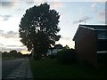
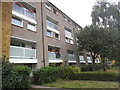
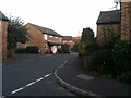
5
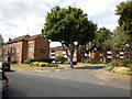
Ham - Beaufort Road
Beaufort Court Estate.
Image: © James Emmans
Taken: 31 Aug 2016
0.05 miles
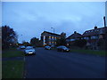
10
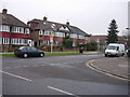
Broughton Avenue
Junction with Lock Road.
Image: © Hugh Venables
Taken: 31 Dec 2008
0.10 miles