IMAGES TAKEN NEAR TO
Sandy Lane, RICHMOND, TW10 7EL
Introduction
This page details the photographs taken nearby to Sandy Lane, TW10 7EL by members of the Geograph project.
The Geograph project started in 2005 with the aim of publishing, organising and preserving representative images for every square kilometre of Great Britain, Ireland and the Isle of Man.

There are currently over 7.5m images from over14,400 individuals and you can help contribute to the project by visiting https://www.geograph.org.uk
Image Map
Images are licensed for reuse under creativecommons.org/licenses/by-sa/2.0
Notes
- Clicking on the map will re-center to the selected point.
- The higher the marker number, the further away the image location is from the centre of the postcode.
Image Listing (22 Images Found)
Images are licensed for reuse under creativecommons.org/licenses/by-sa/2.0
Image
Details
Distance
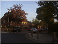
3
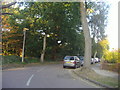
Petersham Road at the junction of Sandy Lane, Ham
Image: © David Howard
Taken: 23 Dec 2014
0.15 miles
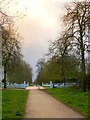
4
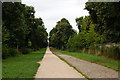
Bridleway at Ham, Surrey
Looking in the direction of Ham House, which lies at the far end of the bridleway.
Image: © Peter Trimming
Taken: 21 Aug 2010
0.15 miles
6
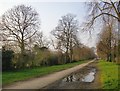
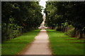
The Great South Avenue, Ham (2)
The view is north (or rather NNW) towards Sandy Lane and Ham House. A bridleway (with puddle!) runs parallel to the footpath.
Image: © Stefan Czapski
Taken: 11 Mar 2016
0.18 miles
7
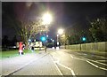
Threatening evening sky over Ham
March 2012 certainly went out like a lamb, with temperatures of over 20C widely reported. But April came in quite boisterously - if not like a lion, then at least like a lion cub. This was the evening sky over Ham on the 12th - the view is a little to the east of south.
Image: © Stefan Czapski
Taken: 12 Apr 2012
0.18 miles
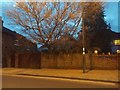
9
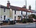
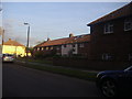
Weather-boarded cottage in Petersham Road
Nineteenth-century photographs show that many buildings in the area around Richmond were once weatherboarded. This little cottage is one of very few which remain in anything like their original state. The cottages to the right are built on a very similar scale, so perhaps the whole of this little terrace was once weather-boarded.
Weather-boarding is said to have flourished from 1784, when the British government imposed a tax on bricks (eventually abolished in 1850).
A collection of early photographs is held in Richmond Borough's Local Studies Collection, at the Old Town Hall, Whittaker Avenue, Richmond. Some images are available on-line:
www.richmond.gov.uk/.../local.../local_studies.../about_local_studies.htm
Image: © Stefan Czapski
Taken: 1 Jan 2011
0.19 miles
10
Bridleway at Ham, Surrey
Looking towards Ham House, which can be seen, in the distance.
Image: © Peter Trimming
Taken: 21 Aug 2010
0.19 miles