
IMAGES TAKEN NEAR TO
Queens Road, RICHMOND, TW10 6JW
Introduction
This page details the photographs taken nearby to Queens Road, TW10 6JW by members of the Geograph project.
The Geograph project started in 2005 with the aim of publishing, organising and preserving representative images for every square kilometre of Great Britain, Ireland and the Isle of Man.

There are currently over 7.5m images from over14,400 individuals and you can help contribute to the project by visiting https://www.geograph.org.uk
Image Map
Images are licensed for reuse under creativecommons.org/licenses/by-sa/2.0
Notes
- Clicking on the map will re-center to the selected point.
- The higher the marker number, the further away the image location is from the centre of the postcode.
Image Listing (87 Images Found)
Images are licensed for reuse under creativecommons.org/licenses/by-sa/2.0
Image
Details
Distance
1
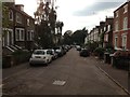
Cambrian Road, Richmond
Taken from just outside the Cambrian Gate, a pedestrian gate into Richmond Park.
Image: © Trevor Harris
Taken: 12 Jul 2014
0.05 miles
2
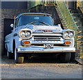
Show me the way to San Jos?: Chevrolet Apache
I don't often submit photos of vehicles to Geograph, on the grounds that they're mobile. But this old Chevy 32 Apache hasn't moved for so long that it seems pretty much a landmark. The San José/California 'license plate' carries the date 1959.
I get the impression that the vehicle is being restored, but it's a slow process.
Image: © Stefan Czapski
Taken: 2 Feb 2012
0.07 miles
3
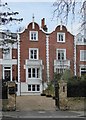
Houses with Dutch gables, Queen's Road, Richmond
There are a number of these handsome buildings along the west side of Queen's Road. Not all retain as much of the original exterior detailing as this pair.
Image: © Stefan Czapski
Taken: 7 Feb 2017
0.08 miles
4
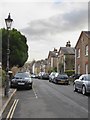
Rosemont Road, Richmond Hill: (1) view south-east
This is a little dead-end street running south-eastwards from Friars Stile Road, stopping just short of Queen's Road.
The houses on the south side are early 'semis', and appear to be all of one build. A string-course at eaves level is enough to hint that the gables are to be read as classical pediments. Most have a little roundel up in the 'pediment', and all have stone quoins. But the 'Georgian' details seem pretty vestigial and I'd guess that the row was built after 1830.
Image: © Stefan Czapski
Taken: 7 Feb 2017
0.08 miles
5
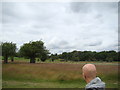
View of the St Matthias Church, Kings Road from Richmond Park
Looking north-northwest.
Image: © Robert Lamb
Taken: 1 Jul 2012
0.09 miles
6
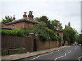
View of a house on the Richmond University campus from Queen's Road
Looking north-northeast.
Image: © Robert Lamb
Taken: 1 Jul 2012
0.09 miles
7
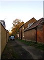
Bishop's Lodge, and the freebord of Richmond Park
When Richmond Park was first enclosed, by King Charles I, the Crown also commandeered a strip of land 16 feet 6 inches wide outside the Park wall. The primary purpose of this strip - the so-called freebord - seems to have been to allow passage along the wall for maintenance purposes. Over the course of centuries much of the freebord has been encroached upon, so that there are now few places where it is still constitutes a public passageway. One such place is here, off Chisholm Road, Richmond, where the freebord gives access to the Park via a pedestrian gate.
The house on the right, built into the Park wall, is known as Bishop's Lodge - because once upon a time a gamekeeper called Bishop lived here.
Image: © Stefan Czapski
Taken: 10 Nov 2010
0.11 miles
8
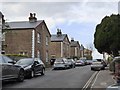
Rosemont Road, Richmond Hill: (2) view north-west
This is a little dead-end street that runs south-east from Friars Stile Road. The houses on the south side are early 'semis', and appear to be all of one build. A string-course at eaves level is a hint that each gable is a classical pediment. Most have a little roundel up in the 'pediment', and all have stone quoins. But the 'Georgian' details are fairly minimal and I'd guess that the row was built after 1830.
Houses on the north side of the street are more varied in style and date.
Image: © Stefan Czapski
Taken: 7 Feb 2017
0.11 miles
9
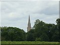
View of the St Matthias Church, Kings Road from Richmond Park #2
Looking north-northeast.
Image: © Robert Lamb
Taken: 1 Jul 2012
0.13 miles
10
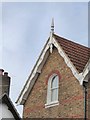
Rosemont Road, Richmond Hill: barge-board detail
Image: © Stefan Czapski
Taken: 7 Feb 2017
0.13 miles