
IMAGES TAKEN NEAR TO
Longhirst, MIDDLESBROUGH, TS8 0TB
Introduction
This page details the photographs taken nearby to Longhirst, TS8 0TB by members of the Geograph project.
The Geograph project started in 2005 with the aim of publishing, organising and preserving representative images for every square kilometre of Great Britain, Ireland and the Isle of Man.

There are currently over 7.5m images from over14,400 individuals and you can help contribute to the project by visiting https://www.geograph.org.uk
Image Map
Images are licensed for reuse under creativecommons.org/licenses/by-sa/2.0
Notes
- Clicking on the map will re-center to the selected point.
- The higher the marker number, the further away the image location is from the centre of the postcode.
Image Listing (11 Images Found)
Images are licensed for reuse under creativecommons.org/licenses/by-sa/2.0
Image
Details
Distance
1
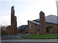
Coulby Newham Roman Catholic Cathedral
Image: © Gordon Elliott
Taken: 15 Nov 2009
0.11 miles
2
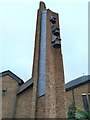
The bell tower of St Mary's RC Cathedral, Middlesbrough
Image: © Luke McCarthy
Taken: 16 Aug 2022
0.11 miles
3
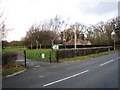
Green Flag Award - Fairy Dell Park
The park authorities in Middlesbrough were awarded a Green Flag Award for 2009/2010 for the wonderful work done in organising and maintaining the park, dell and wetlands at Fairy Dell. See here: http://www.greenflagaward.org.uk. The award is symbolised by the 'green flag' hanging from the flag-pole just inside (and to the right of) the park entrance. For further details of Fairy Dell's Green Flag Award see here http://www.keepbritaintidy.org/GreenFlag/GreenFlagAwardSites/NorthEast/Default.aspx?parkID=885.
Image: © Philip Barker
Taken: 26 Nov 2009
0.12 miles
4
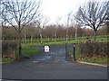
Entrance to Fairy Dell Park
The parkland shown above lies just west of Fairy Dell through which Marton West Beck runs in a north-westerly direction. The park was awarded a Green Flag Award in 2009/2010.
Image: © Philip Barker
Taken: 26 Nov 2009
0.12 miles
5
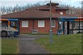
Parked Up Buses
At Coulby Newham shops.
Image: © Mick Garratt
Taken: 26 Mar 2009
0.16 miles
6
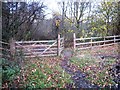
Gated access to Fairy Dell
This entrance into Fairy Dell provides access to Marton West Beck and Fairy Dell Bridge by means of a 'gentle slope' through the wooded area near the road junction and St Augustine's RC primary School. There is an alternative entrance (using a wooden flight of steps) leading down from Gunnergate Lane - about 100 yards to the right of where this photograph was taken. See here Image and here Image
Image: © Philip Barker
Taken: 26 Nov 2009
0.16 miles
9
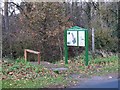
Entrance to Fairy Dell from Gunnergate Lane
This entrance to Fairy Dell provides access to Marton West Beck by means of a wooden flight of steps that leads down to Fairy Dell Ford and Bridge. Just before the steps there is a useful notice board containing an annotated map of the Dell to enable visitors to see the different walks and features available for them to view. The steps are shown here: http://www.geograph.org.uk/photo/1597017.
Image: © Philip Barker
Taken: 26 Nov 2009
0.20 miles
10
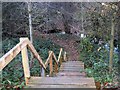
Steps down to Fairy Dell from Gunnergate Lane
These steps lead down from Gunnergate Lane to Fairy Dell Bridge in Fairy Dell. Marton West Beck can be seen 'coming in' from the right-hand side of the picture. The bridge can be seen just left of centre. Viewers with really good eye-sight might notice the 'yellow' public-footpath sign just to the left of the fourth notch on the tree depicted in the foreground of the picture (just behind the hand-rail of the steps). The post to which the sign is fixed is less discernible.
Image: © Philip Barker
Taken: 26 Nov 2009
0.20 miles