
IMAGES TAKEN NEAR TO
Whinlatter Close, MIDDLESBROUGH, TS6 0FA
Introduction
This page details the photographs taken nearby to Whinlatter Close, TS6 0FA by members of the Geograph project.
The Geograph project started in 2005 with the aim of publishing, organising and preserving representative images for every square kilometre of Great Britain, Ireland and the Isle of Man.

There are currently over 7.5m images from over14,400 individuals and you can help contribute to the project by visiting https://www.geograph.org.uk
Image Map
Images are licensed for reuse under creativecommons.org/licenses/by-sa/2.0
Notes
- Clicking on the map will re-center to the selected point.
- The higher the marker number, the further away the image location is from the centre of the postcode.
Image Listing (5 Images Found)
Images are licensed for reuse under creativecommons.org/licenses/by-sa/2.0
Image
Details
Distance
1

Bracken Infested Semi-Open Land
Flatts Lane Country Park.
Image: © Mick Garratt
Taken: 4 Nov 2007
0.08 miles
2
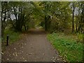
Driveway for the former brickworks, Flatts Lane Country Park
Image: © Humphrey Bolton
Taken: 27 Oct 2022
0.12 miles
3

Parkway traffic near Normanby
This photograph shows a view of the traffic on the A174(T) road that runs between Lackenby (in the east) and Thornaby (in the west). The picture was taken from the bridge over the road (near High Cow How) looking in a westerly direction towards Ormesby.
Image: © Philip Barker
Taken: 4 Feb 2010
0.18 miles
4
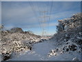
Pylons in the snow near Flatts Lane (view north)
This photograph depicts a run of pylons and electricity cables passing through the Flatts Lane Country Park in a northerly direction. A part of industrial Teesside can just be seen in the distance and the North Sea is visible on the horizon. Without the snow and before the unchecked growth of bushes, this scene used to look like this: Image .
Image: © Philip Barker
Taken: 20 Dec 2009
0.23 miles
5
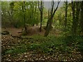
Clay mining earthworks, Flatts Lane Woodland Country Park
The land in the park was originally owned by a brickworks.
Image: © Humphrey Bolton
Taken: 27 Oct 2022
0.24 miles