
IMAGES TAKEN NEAR TO
Coltman Street, MIDDLESBROUGH, TS3 6JA
Introduction
This page details the photographs taken nearby to Coltman Street, TS3 6JA by members of the Geograph project.
The Geograph project started in 2005 with the aim of publishing, organising and preserving representative images for every square kilometre of Great Britain, Ireland and the Isle of Man.

There are currently over 7.5m images from over14,400 individuals and you can help contribute to the project by visiting https://www.geograph.org.uk
Image Map
Images are licensed for reuse under creativecommons.org/licenses/by-sa/2.0
Notes
- Clicking on the map will re-center to the selected point.
- The higher the marker number, the further away the image location is from the centre of the postcode.
Image Listing (20 Images Found)
Images are licensed for reuse under creativecommons.org/licenses/by-sa/2.0
Image
Details
Distance
1
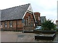
North Ormseby Community Centre
A former school, still marked on the map as such, but now used as a community centre.
Image: © Mick Garratt
Taken: 1 Dec 2005
0.08 miles
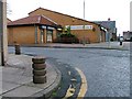
3
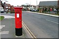
Post Box, Westbourne Grove
Near its junction with Kings Road. St. Alphonsus RC Church Hall is on the right.
Image: © Mick Garratt
Taken: 29 Feb 2008
0.12 miles
4
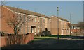
Whickham Close
Mostly boarded up and scheduled for demolition. Can't be more than twenty year old.
Image: © Mick Garratt
Taken: 29 Nov 2007
0.13 miles
5
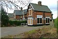
Boarded Up Doctors Surgery, Oakfield Road
Image: © Mick Garratt
Taken: 29 Feb 2008
0.13 miles
6
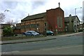
St. Alphonsus RC Church, Kings Road
At its junction with Westbourne Grove which can be seen just on the right.
Image: © Mick Garratt
Taken: 29 Feb 2008
0.16 miles
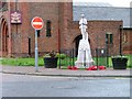
8
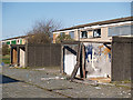
Whickham Close
Five months on from Mick Garratt's picture, just over the gridline Image and still awaiting demolition.
If they don't start soon there will be nothing left to demolish.
Image: © Stephen McCulloch
Taken: 15 Apr 2008
0.16 miles
9
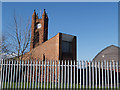
Holy Trinity Church
Viewed from the rear, showing the new church hall.
Image: © Stephen McCulloch
Taken: 15 Apr 2008
0.16 miles
10
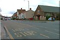
Kings Road
The building on the right is the church hall next to the St. Alphonsus RC Church.
Image: © Mick Garratt
Taken: 29 Feb 2008
0.17 miles