IMAGES TAKEN NEAR TO
Myra Avenue, HARTLEPOOL, TS27 4PX
Introduction
This page details the photographs taken nearby to Myra Avenue, TS27 4PX by members of the Geograph project.
The Geograph project started in 2005 with the aim of publishing, organising and preserving representative images for every square kilometre of Great Britain, Ireland and the Isle of Man.

There are currently over 7.5m images from over14,400 individuals and you can help contribute to the project by visiting https://www.geograph.org.uk
Image Map
Images are licensed for reuse under creativecommons.org/licenses/by-sa/2.0
Notes
- Clicking on the map will re-center to the selected point.
- The higher the marker number, the further away the image location is from the centre of the postcode.
Image Listing (12 Images Found)
Images are licensed for reuse under creativecommons.org/licenses/by-sa/2.0
Image
Details
Distance
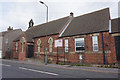
2
Church Street Hesleden County Durham
Image: © Peter Robinson
Taken: 11 Nov 2010
0.07 miles
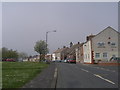
3
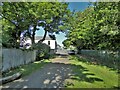
Bridleway approaching Church Street
The bridleway enters Hesleden by the side of Hesleden House
Image: © Kevin Waterhouse
Taken: 14 Jun 2023
0.08 miles
4
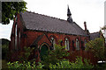
Hesleden Church
Parish Church of Hesleden near Hartlepool
Image: © George Ford
Taken: 10 Aug 2005
0.11 miles
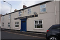
5
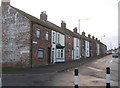
High Hesleden Community Centre on Front Street
Image: © Ian S
Taken: 12 Sep 2020
0.13 miles
7
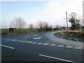
Road junction at Hesleden Road
This photograph shows a view of the minor road (straight ahead) that leads into the village of Hesleden. The photograph was taken, looking in a south-easterly direction, at the junction of this road with the B1281 that runs between Castle Eden (to the right) and Blackhall Colliery (to the left).
Image: © Philip Barker
Taken: 17 Jan 2010
0.16 miles
9
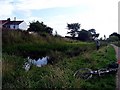
Pond adjacent Haswell to Hart cycle track
Image: © Roger Smith
Taken: 9 Aug 2009
0.20 miles
10
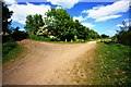
Track junction near Hesleden
This photograph shows a view of a track junction formed by the intersection of the Haswell to Hart Cycleway/Walkway (running from left to right) with the track/footpath from the village of Hesleden (joining from the top left). The picture was taken looking in an east-north-easterly direction towards High Hesleden.
Image: © Philip Barker
Taken: 2 Jun 2010
0.20 miles