IMAGES TAKEN NEAR TO
Coast Road, HARTLEPOOL, TS27 3AA
Introduction
This page details the photographs taken nearby to Coast Road, TS27 3AA by members of the Geograph project.
The Geograph project started in 2005 with the aim of publishing, organising and preserving representative images for every square kilometre of Great Britain, Ireland and the Isle of Man.

There are currently over 7.5m images from over14,400 individuals and you can help contribute to the project by visiting https://www.geograph.org.uk
Image Map
Images are licensed for reuse under creativecommons.org/licenses/by-sa/2.0
Notes
- Clicking on the map will re-center to the selected point.
- The higher the marker number, the further away the image location is from the centre of the postcode.
Image Listing (28 Images Found)
Images are licensed for reuse under creativecommons.org/licenses/by-sa/2.0
Image
Details
Distance
1
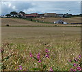
Crimdon House Farm near Hartlepool
Viewed from the England Coast Path.
Image: © Mat Fascione
Taken: 26 Aug 2017
0.02 miles
3
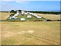
Caravan site at Crimdon House
A touring site. Viewed from the footbridge at the old Hart station
Image: © Oliver Dixon
Taken: 24 Jul 2006
0.08 miles
4
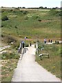
Footbridge over the mouth of Crimdon Dene
This path from Crimdon cliffs to the old Hart station was constructed as part of the Turning the Tide project. http://www.turning-the-tide.org.uk/
Image: © Oliver Dixon
Taken: 24 Jul 2006
0.11 miles
6
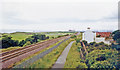
Site of Hart station
View SE, towards Hartlepool, Stockton etc.: ex-NER Durham Coast main line, Newcastle - Sunderland - West Hartlepool - Stockton - Eaglescliffe and South/Thornaby - Middlesbrough etc. The station closed finally to passengers 31/8/53, having been closed 7/41 - 5/46 and then only opened irregularly. Until closed 7/6/52 (9/63 for goods), the earlier line from Ferryhill (and from Sunderland) via Castle Eden had joined the Coast line here from the west, behind the camera. (Cf. Image]).
Image: © Ben Brooksbank
Taken: 23 Jun 2002
0.14 miles
9
Heading for Sunderland
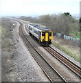
A rattly old DMU heads up the coast line out of Hartlepool towards Sunderland, although the sign in the cab suggests that the ultimate destination is Hexham.
Image: © Gordon Hatton
Taken: 18 Mar 2019
0.16 miles