Site of Hart station
Introduction
The photograph on this page of Site of Hart station by Ben Brooksbank as part of the Geograph project.
The Geograph project started in 2005 with the aim of publishing, organising and preserving representative images for every square kilometre of Great Britain, Ireland and the Isle of Man.

There are currently over 7.5m images from over 14,400 individuals and you can help contribute to the project by visiting https://www.geograph.org.uk
Site of Hart station
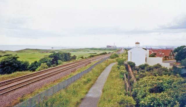
Image: © Ben Brooksbank Taken: 23 Jun 2002
View SE, towards Hartlepool, Stockton etc.: ex-NER Durham Coast main line, Newcastle - Sunderland - West Hartlepool - Stockton - Eaglescliffe and South/Thornaby - Middlesbrough etc. The station closed finally to passengers 31/8/53, having been closed 7/41 - 5/46 and then only opened irregularly. Until closed 7/6/52 (9/63 for goods), the earlier line from Ferryhill (and from Sunderland) via Castle Eden had joined the Coast line here from the west, behind the camera. (Cf. Image]).
Images are licensed for reuse under creativecommons.org/licenses/by-sa/2.0
Image Location
Latitude
54.719389
Longitude
-1.251701