IMAGES TAKEN NEAR TO
Fieldfare Lane, STOCKTON-ON-TEES, TS20 1LH
Introduction
This page details the photographs taken nearby to Fieldfare Lane, TS20 1LH by members of the Geograph project.
The Geograph project started in 2005 with the aim of publishing, organising and preserving representative images for every square kilometre of Great Britain, Ireland and the Isle of Man.

There are currently over 7.5m images from over14,400 individuals and you can help contribute to the project by visiting https://www.geograph.org.uk
Image Map (Loading...)


Getting Data...Please wait
Leaflet Map data © OpenStreetMap
Images are licensed for reuse under creativecommons.org/licenses/by-sa/2.0
Notes
- Clicking on the map will re-center to the selected point.
- The higher the marker number, the further away the image location is from the centre of the postcode.
Image Listing (18 Images Found)
Images are licensed for reuse under creativecommons.org/licenses/by-sa/2.0
Image
Details
Distance
1
King Edwin's School, formerly Bishopsmill School
An early Christian cemetery was excavated when an extension was added to revamp the school in 2003. 100 skeletons were discovered.
Image: © Carol Rose
Taken: 1 Jul 2007
0.10 miles
2
Crooks Barn Lane
Gives its name to the newer Crooksbarn housing estate built in the 1960's and 70's.
Image: © Carol Rose
Taken: 1 Jul 2007
0.13 miles
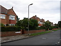
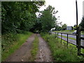
3
Norton, Mill Lane
According to the OS benchmark database there was a mark cut into a wall at this location. Today, there is a new property with a new brick wall. The benchmark has been destroyed.
Image: © Mel Towler
Taken: 19 Feb 2022
0.13 miles
4
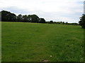
The plague pit
As it is known locally is an open piece of land between the houses of the estate. The houses were built in the 1930's and at that time many Anglo Saxon burials were found in the area. Excavations of this land revealed 'shovelfuls' of bones which possibly indicated disease and hasty burial in a pit.
Image: © Carol Rose
Taken: 1 Jul 2007
0.15 miles
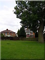
5
The Anglo Saxon Burial ground.
Excavated in 1984, this cemetery yielded 120 burials with grave goods. It was in use between 550AD and 610AD.
Image: © Carol Rose
Taken: 1 Jul 2007
0.15 miles
7
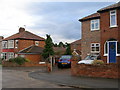
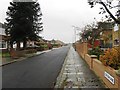
View of the housing estate from Cottersloe Road
Image: © Carol Rose
Taken: 1 Jul 2007
0.16 miles
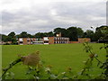
8
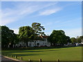
Norton Hall from across Norton Green
Norton Hall is now converted into wonderful apartments- imagine having the ballroom as part of your flat! Before this the building was used by ICI to wine and dine guests.
Image: © Carol Rose
Taken: 25 Apr 2007
0.16 miles
9
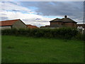
Northcote Hill farmhouse is now converted to a family home
The land around it now houses the small cul-de-sac of Bishopsmill.
Image: © Carol Rose
Taken: 1 Jul 2007
0.18 miles