IMAGES TAKEN NEAR TO
Fairmead, REDCAR, TS10 4QE
Introduction
This page details the photographs taken nearby to Fairmead, TS10 4QE by members of the Geograph project.
The Geograph project started in 2005 with the aim of publishing, organising and preserving representative images for every square kilometre of Great Britain, Ireland and the Isle of Man.

There are currently over 7.5m images from over14,400 individuals and you can help contribute to the project by visiting https://www.geograph.org.uk
Image Map
Images are licensed for reuse under creativecommons.org/licenses/by-sa/2.0
Notes
- Clicking on the map will re-center to the selected point.
- The higher the marker number, the further away the image location is from the centre of the postcode.
Image Listing (11 Images Found)
Images are licensed for reuse under creativecommons.org/licenses/by-sa/2.0
Image
Details
Distance
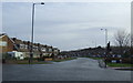
1
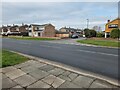
West Dyke Road
Approaching the junction with the A1042.
Image: © Oliver Dixon
Taken: 15 Feb 2023
0.08 miles
2
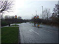
Traffic light controlled junction on Kirkleatham Lane (A1042)
Heading south.
Image: © JThomas
Taken: 25 Jan 2014
0.09 miles
3
West Dyke Road
Heading east from Kirkleatham Lane.
Image: © JThomas
Taken: 25 Jan 2014
0.09 miles
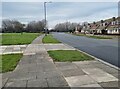
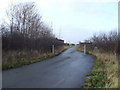
4
Meadway off West Dyke Road
Suburban streets in the south-west corner of Redcar.
Image: © Oliver Dixon
Taken: 15 Feb 2023
0.11 miles
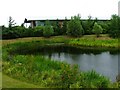
6
Path towards Police HQ
Heading west from Kirkleatham Lane.
Image: © JThomas
Taken: 25 Jan 2014
0.11 miles
7
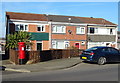
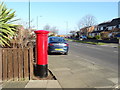
Houses on West Dyke Road, Redcar
Showing position of Postbox No. TS10 554.
See Image] for postbox.
Image: © JThomas
Taken: 23 Feb 2019
0.17 miles
8
West Dyke Road, Redcar
Showing position of Postbox No. TS10 554.
See Image] for postbox.
Image: © JThomas
Taken: 23 Feb 2019
0.17 miles
9
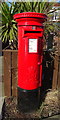
Elizabeth II postbox on West Dyke Road, Redcar
Image: © JThomas
Taken: 23 Feb 2019
0.18 miles