
IMAGES TAKEN NEAR TO
Tredrea Gardens, TRURO, TR3 7QG
Introduction
This page details the photographs taken nearby to Tredrea Gardens, TR3 7QG by members of the Geograph project.
The Geograph project started in 2005 with the aim of publishing, organising and preserving representative images for every square kilometre of Great Britain, Ireland and the Isle of Man.

There are currently over 7.5m images from over14,400 individuals and you can help contribute to the project by visiting https://www.geograph.org.uk
Image Map
Images are licensed for reuse under creativecommons.org/licenses/by-sa/2.0
Notes
- Clicking on the map will re-center to the selected point.
- The higher the marker number, the further away the image location is from the centre of the postcode.
Image Listing (28 Images Found)
Images are licensed for reuse under creativecommons.org/licenses/by-sa/2.0
Image
Details
Distance
3
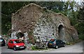
Old Lime Kiln at Perranarworthal
These lime kilns are a common feature of the estuaries and inlets of Cornwall and West Devon. Limestone, brought in by sea, was burned to produce quicklime which could be spread on fields to improve the rather poor acid soils.
Image: © Tony Atkin
Taken: 29 Apr 2006
0.08 miles
4
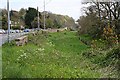
Perran Wharf
Now completely silted up, in the 19th century, ships would have docked here on the tide.
Image: © Tony Atkin
Taken: 29 Apr 2006
0.08 miles
5
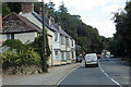
The A39
Passing through Perranarworthal.
Image: © Robert Ashby
Taken: 19 Aug 2014
0.08 miles
6
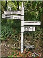
Direction Sign ? Signpost
Located on the southeast side of the road at the top of Cove Hill in Perranarworthal parish. 4 replacement arms and pyramid spear finial. For an earlier photo, see https://www.geograph.org.uk/photo/6097899.
Milestone Society National ID: CW_SW7738
Image: © D Church
Taken: 15 Sep 2019
0.09 miles
7
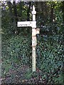
Direction Sign - Signpost by Cove Hill, Perranarworthal
4 broken arms and pyramid spear finial; Cornwall column by the UC road, in parish of Perranarworthal (Carrick District), top of Cove Hill, East side of the road.
Cornwall & Scilly HER.
HER Number: MCO56748 https://www.heritagegateway.org.uk/Gateway/Results_Single.aspx?uid=MCO56748&resourceID=1020
Surveyed
Milestone Society National ID: CW_SW7738
Image: © Milestone Society
Taken: 1 Jan 2012
0.10 miles
8
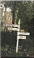
Direction Sign – Signpost
Located on the southeast side of the road at the top of Cove Hill in Perranarworthal parish. 4 replacement arms and pyramid spear finial. For an earlier photo, see https://www.geograph.org.uk/photo/6511165.
Milestone Society National ID: CW_SW7738
Image: © Paul Barnett
Taken: 1 Apr 2023
0.10 miles
9
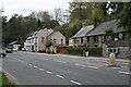
Houses along Perran Wharf, Perranarworthal
The creek in which ships would have docked in the 19th century (off picture to the left) has long since silted up. The main road between Truro and Falmouth (A39) now runs where the dockside used to be.
Image: © Tony Atkin
Taken: 29 Apr 2006
0.10 miles
