
IMAGES TAKEN NEAR TO
Sancreed, PENZANCE, TR20 8RE
Introduction
This page details the photographs taken nearby to TR20 8RE by members of the Geograph project.
The Geograph project started in 2005 with the aim of publishing, organising and preserving representative images for every square kilometre of Great Britain, Ireland and the Isle of Man.

There are currently over 7.5m images from over14,400 individuals and you can help contribute to the project by visiting https://www.geograph.org.uk
Image Map
Images are licensed for reuse under creativecommons.org/licenses/by-sa/2.0
Notes
- Clicking on the map will re-center to the selected point.
- The higher the marker number, the further away the image location is from the centre of the postcode.
Image Listing (5 Images Found)
Images are licensed for reuse under creativecommons.org/licenses/by-sa/2.0
Image
Details
Distance
1
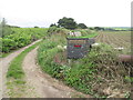
The lane to Moor Magi
The farm name is spelt differently [Magy] on the OS map.
Image: © David Medcalf
Taken: 10 Jun 2012
0.20 miles
2
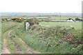
Wayside cross near Boswarthen
On the right of the horizon can be seen the tall tower of St Buryan church.
Image: © Rod Allday
Taken: 4 May 2009
0.21 miles
3
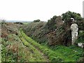
Wayside cross near Boswarthen
Also known as Brane Cross. An eroded medieval wheel head cross, marking the path to Sancreed church and the bounds between Brane and Boswarthen estates.
Image: © Andrew Curtis
Taken: 7 Oct 2016
0.21 miles
4
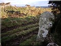
Old Wayside Cross
Brane Cross, a wayside cross with an old head & shaft. Set beside a footpath heading north. Sancreed parish. Langdon WP No.86. Grade II Listed https://historicengland.org.uk/listing/the-list/list-entry/1143854. See also http://www.geograph.org.uk/photo/505324 and http://www.flickr.com/photos/ocifant/2478925190.
Milestone Society National ID: CWPW_SAN02
Image: © L Nott
Taken: 1 Jan 2019
0.22 miles
5
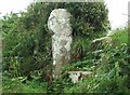
Brane Cross
This cross stands beside a stile on the ancient churchway between the hamlet of Brane and Sancreed.
Image: © Malcolm Kewn
Taken: 25 Jul 2007
0.23 miles