IMAGES TAKEN NEAR TO
Sennen, PENZANCE, TR19 7AF
Introduction
This page details the photographs taken nearby to TR19 7AF by members of the Geograph project.
The Geograph project started in 2005 with the aim of publishing, organising and preserving representative images for every square kilometre of Great Britain, Ireland and the Isle of Man.

There are currently over 7.5m images from over14,400 individuals and you can help contribute to the project by visiting https://www.geograph.org.uk
Image Map
Images are licensed for reuse under creativecommons.org/licenses/by-sa/2.0
Notes
- Clicking on the map will re-center to the selected point.
- The higher the marker number, the further away the image location is from the centre of the postcode.
Image Listing (11 Images Found)
Images are licensed for reuse under creativecommons.org/licenses/by-sa/2.0
Image
Details
Distance
2
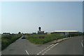
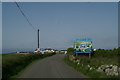
Treeve Moor B&B
This looking north from the road which goes through Sennen out to Lands End, at Treeve Moor
Image: © Paula Goodfellow
Taken: 29 Jun 2005
0.11 miles
3
The start of The Cornish Way
The start of the cycle route which leads eventually to John O'Groats.
Image: © David Medcalf
Taken: 29 Aug 2015
0.11 miles
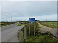
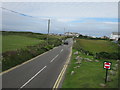
4
Welcome to Land's End
End of the road for the A30.
Image: © JThomas
Taken: 13 Jul 2017
0.14 miles
7
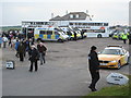
Arriving for the start of the Olympic Torch Relay at Land's End
Spectators disembarking at 5.50am from the park & ride coaches laid on for the start of the torch relay.
Image: © Rod Allday
Taken: 19 May 2012
0.20 miles
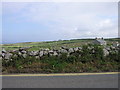
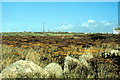
8
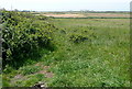
Treve Common
Only a mile from Land's End, which complex can be seen in the distance, but a million miles away in terms of business and scenic quality (I'll leave you to judge for better or worse).
Image: © Graham Horn
Taken: 4 Jul 2011
0.21 miles
9
Land's End - 1982
Land's End, Cornwall, Trevescan Cliff, Sennen Cove visible in the distance.
Land's End is a headland and small settlement in west Cornwall, England, within the United Kingdom. It is located on the Penwith peninsula approximately 13 km west-southwest of Penzance.
Land's End is the extreme westerly point on the mainland of England.
Land's End has a particular resonance because it is often used to suggest distance. Land's End to John o' Groats in Scotland is a distance of 1349 km by road and this Land's End to John o' Groats distance is often used to define races, walks or charitable events in the UK.
Image: © Helmut Zozmann
Taken: 20 Aug 1982
0.21 miles
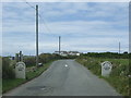
10
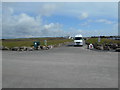
Just finishing?
A local'hopper bus' arrives at the famous start or finishing point at Lands End.
Image: © Anthony Vosper
Taken: 9 Apr 2019
0.24 miles