IMAGES TAKEN NEAR TO
Coombe Meadow, PENZANCE, TR18 3FB

Introduction

This page details the photographs taken nearby to Coombe Meadow, TR18 3FB by members of the Geograph project.

The Geograph project started in 2005 with the aim of publishing, organising and preserving representative images for every square kilometre of Great Britain, Ireland and the Isle of Man.

There are currently over 7.5m images from over14,400 individuals and you can help contribute to the project by visiting https://www.geograph.org.uk

Image Map


Images are licensed for reuse under creativecommons.org/licenses/by-sa/2.0
Notes
  • Clicking on the map will re-center to the selected point.
  • The higher the marker number, the further away the image location is from the centre of the postcode.

Image Listing (35 Images Found)

Images are licensed for reuse under creativecommons.org/licenses/by-sa/2.0
  • ...
Image
Details
Distance
1
Lower Trannack Farm
Basking in winter sunlight.
Image: © Malcolm Kewn Taken: 20 Nov 2009
0.06 miles
2
A30 Penzance Bypass
Image: © Roy Hughes Taken: 1 Jul 2016
0.08 miles
3
Short cut
Entrance to (or exit from!) the short section of a footpath bisected by the construction of Pendennis Road in the early 1970s.
Image: © Malcolm Kewn Taken: 1 Jul 2012
0.09 miles
4
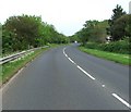
Down the road
Looking in the direction of Mount's Bay along the Penzance Distributor Road, part of the A30.
Image: © Malcolm Kewn Taken: 11 May 2008
0.10 miles
5
Keeping the home fires burning
Fuel depot located in a long-disused quarry.
Image: © Malcolm Kewn Taken: 16 Apr 2013
0.10 miles
6
Lower Peverell Road
Seen in hazy evening light.
Image: © Malcolm Kewn Taken: 24 Jul 2012
0.10 miles
7
Treneere Estate, north of Penzance
Seen across fields from the hilltop north-east of the estate
Image: © David Smith Taken: 14 Mar 2016
0.11 miles
8
Coombe Cottage
Another erstwhile farm building converted to modern dwelling. The original Coombe Cottage stood almost directly opposite this building; it was a Grade II listed, thatched-roofed traditional cottage which, shamefully, was allowed to fall into ruin in the 1980s. All that remains now are the pitiful, overgrown remnants of some of its walls. The Penzance Distributor Road section of the A30 now separates the two.
Image: © Malcolm Kewn Taken: 16 Apr 2013
0.13 miles
9
Coombe Cottage
Another erstwhile farm building converted to modern dwelling. The original Coombe Cottage stood almost directly opposite this building; it was a Grade II listed, thatched-roofed traditional cottage which, shamefully, was allowed to fall into ruin in the 1980s. All that remains now are the pitiful, overgrown remnants of some of its walls. The Penzance Distributor Road section of the A30 now separates the two.
Image: © Malcolm Kewn Taken: 16 Apr 2013
0.13 miles
10
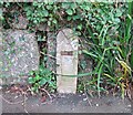
GPO marker
Left over from the days when the GPO operated the telephone system, these apparently mark the presence of inspection chambers.
Image: © Malcolm Kewn Taken: 21 Aug 2008
0.14 miles
  • ...