Coombe Cottage
Introduction
The photograph on this page of Coombe Cottage by Malcolm Kewn as part of the Geograph project.
The Geograph project started in 2005 with the aim of publishing, organising and preserving representative images for every square kilometre of Great Britain, Ireland and the Isle of Man.

There are currently over 7.5m images from over 14,400 individuals and you can help contribute to the project by visiting https://www.geograph.org.uk
Coombe Cottage
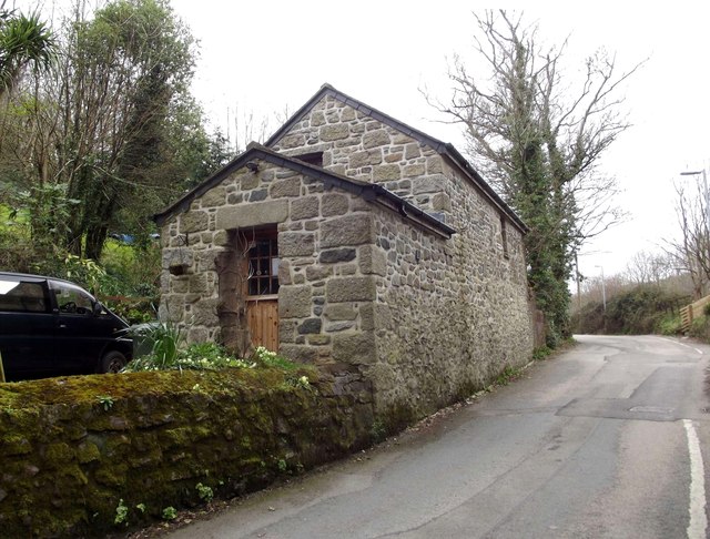
Image: © Malcolm Kewn Taken: 16 Apr 2013
Another erstwhile farm building converted to modern dwelling. The original Coombe Cottage stood almost directly opposite this building; it was a Grade II listed, thatched-roofed traditional cottage which, shamefully, was allowed to fall into ruin in the 1980s. All that remains now are the pitiful, overgrown remnants of some of its walls. The Penzance Distributor Road section of the A30 now separates the two.
Images are licensed for reuse under creativecommons.org/licenses/by-sa/2.0
Image Location
Latitude
50.127491
Longitude
-5.533806