
IMAGES TAKEN NEAR TO
Penare Road, PENZANCE, TR18 2BG
Introduction
This page details the photographs taken nearby to Penare Road, TR18 2BG by members of the Geograph project.
The Geograph project started in 2005 with the aim of publishing, organising and preserving representative images for every square kilometre of Great Britain, Ireland and the Isle of Man.

There are currently over 7.5m images from over14,400 individuals and you can help contribute to the project by visiting https://www.geograph.org.uk
Image Map
Images are licensed for reuse under creativecommons.org/licenses/by-sa/2.0
Notes
- Clicking on the map will re-center to the selected point.
- The higher the marker number, the further away the image location is from the centre of the postcode.
Image Listing (271 Images Found)
Images are licensed for reuse under creativecommons.org/licenses/by-sa/2.0
Image
Details
Distance
2

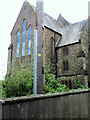
Leskinnick Terrace, Penzance
Like many houses in Penzance which were the homes of artisans in Penzance, Leskinnick Terrace was, for instance, the home of George Lamsin the signalman in the signal box just outside Penzance Station which was at the foot of the hill. He lived here from the 1870s to 1913 at number 37.
Image: © Ken Ripper
Taken: 22 Sep 2004
0.09 miles
4
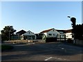
St Mary's
Roman Catholic primary school.
Image: © Malcolm Kewn
Taken: 24 Jul 2012
0.12 miles
5
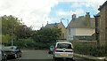
Empress Avenue
The buildings between the end of Empress Avenue and St Mary's Street are now the St. Mary's Haven Residential Care Home https://maps.app.goo.gl/3VfkAiWBrRyc3LD56 . The Home's website https://www.ansoncare.co.uk/st-marys-haven-care-home-in-penzance-cornwall/ says that it was "Originally a series of buildings which included St Gertrudes Convent ... " and that "The site also includes a small Chapel ... " - the west gable end and the roof of which can be seen in the photo. Streetview https://maps.app.goo.gl/nAyNwx9vqJFYGJKW6 shows that the view in the photo is no longer obtainable because the house on the east side at the top end of Medrose Terrace seems to have been extended sometime after 2014 and is now rectangular, rather than angled on its north side as seen in the satellite image https://wtp2recorder.appspot.com/wheresthepath.htm?lat=50.123250&lon=-5.538935&lz=18&rz=19<=OS&rt=satellite&lov=None&rov=None&lgrat=None&rgrat=None .
Image: © Paul Barnett
Taken: 1 Jan 2014
0.13 miles
6
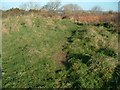
Lescudjack hillfort
Inside the sadly neglected Lescudjack hillfort, the oldest man-made structure in Penzance.
Image: © Malcolm Kewn
Taken: 2 Dec 2004
0.13 miles
7
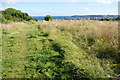
Lescudjack Hill
The highest point in Penzance and the site of a neolithic settlement.
Image: © Bill Boaden
Taken: 9 Jul 2014
0.14 miles
8
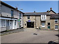
St Michael's Mews, Penzance
In early June 2016, a blue For Sale board is above the entrance
to St Michael's Mews on the corner of Penwith Street and Mount Street.
Image: © Jaggery
Taken: 4 Jun 2016
0.15 miles
9
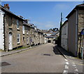
Penwith Street, Penzance
Looking to the NE along Penwith Street from the corner of Adelaide Street.
Image: © Jaggery
Taken: 4 Jun 2016
0.15 miles
10
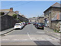
St Mary's Street, Penzance
Viewed from Taroveor Road.
Image: © Jaggery
Taken: 4 Jun 2016
0.16 miles