IMAGES TAKEN NEAR TO
Carnkie, REDRUTH, TR16 6SJ
Introduction
This page details the photographs taken nearby to TR16 6SJ by members of the Geograph project.
The Geograph project started in 2005 with the aim of publishing, organising and preserving representative images for every square kilometre of Great Britain, Ireland and the Isle of Man.

There are currently over 7.5m images from over14,400 individuals and you can help contribute to the project by visiting https://www.geograph.org.uk
Image Map
Images are licensed for reuse under creativecommons.org/licenses/by-sa/2.0
Notes
- Clicking on the map will re-center to the selected point.
- The higher the marker number, the further away the image location is from the centre of the postcode.
Image Listing (20 Images Found)
Images are licensed for reuse under creativecommons.org/licenses/by-sa/2.0
Image
Details
Distance
1
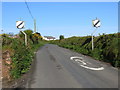
Road from Carnkie to Piece
Looking north-westward from Carnkie Farm.
Image: © Peter Wood
Taken: 2 May 2017
0.09 miles
2

Track leading into the Bowling Green, Campsite
Image: © Pete Cruse
Taken: 16 May 2025
0.10 miles
3
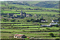
View from Carn Brea
The farms and fields in the foreground are all in this square, but the view is dominated by one of the many ruined mines that dot the country around Redruth.
Image: © Anne Burgess
Taken: 13 May 2018
0.12 miles
4
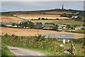
Carnkie Farm
Looking down onto the western edge of the village of Carnkie from the old Basset Tramway at Higher Carnkie. On the horizon the De Dunstanville memorial is prominent on top of Carn Brea hill.
Image: © Tony Atkin
Taken: 21 Aug 2007
0.13 miles
5

Entrance to a campsite with a stall of free range eggs for sale
Image: © Pete Cruse
Taken: 16 May 2025
0.15 miles
6
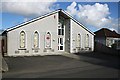
Carnkie Community Institute
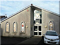
The panels on the front of this building detail the history of the village and the surrounding mines. There is a lot of reading here! Below the panels are name plaques very much in the style of 19th century Methodist churches.
Image: © Tony Atkin
Taken: 3 Mar 2007
0.19 miles
9
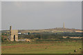
Thomas's pumping engine house - West Wheal Basset
The engine house is precisely located. The photographer less so but I believe I was more or less in the parking area for the Great Flat Lode near South Wheal Frances.
This house was erected in 1854 for a 60" Cornish beam pump and is the oldest surviving engine house on the Great Flat Lode. The engine was damaged in a fire in 1896 but continued to work slowly to provide water for dressing floors (underground activity having ceased by then). It was finally stopped in 1899 and its bob reused as an underground balance bob elsewhere. In the background is the monument atop Carn Brea.
Image: © Chris Allen
Taken: 26 Sep 2008
0.20 miles