Carnkie Community Institute
Introduction
The photograph on this page of Carnkie Community Institute by Tony Atkin as part of the Geograph project.
The Geograph project started in 2005 with the aim of publishing, organising and preserving representative images for every square kilometre of Great Britain, Ireland and the Isle of Man.

There are currently over 7.5m images from over 14,400 individuals and you can help contribute to the project by visiting https://www.geograph.org.uk
Carnkie Community Institute
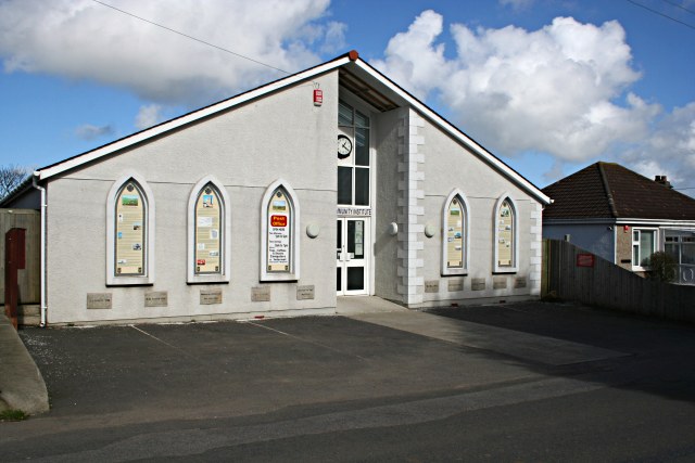
Image: © Tony Atkin Taken: 3 Mar 2007
The panels on the front of this building detail the history of the village and the surrounding mines. There is a lot of reading here! Below the panels are name plaques very much in the style of 19th century Methodist churches.
Images are licensed for reuse under creativecommons.org/licenses/by-sa/2.0
Image Location
Latitude
50.214026
Longitude
-5.244665