
IMAGES TAKEN NEAR TO
Chapel Street, REDRUTH, TR16 5NE
Introduction
This page details the photographs taken nearby to Chapel Street, TR16 5NE by members of the Geograph project.
The Geograph project started in 2005 with the aim of publishing, organising and preserving representative images for every square kilometre of Great Britain, Ireland and the Isle of Man.

There are currently over 7.5m images from over14,400 individuals and you can help contribute to the project by visiting https://www.geograph.org.uk
Image Map
Images are licensed for reuse under creativecommons.org/licenses/by-sa/2.0
Notes
- Clicking on the map will re-center to the selected point.
- The higher the marker number, the further away the image location is from the centre of the postcode.
Image Listing (22 Images Found)
Images are licensed for reuse under creativecommons.org/licenses/by-sa/2.0
Image
Details
Distance
2
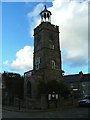
Town Clock, St Day
Standing in the market square of this famous mining village
Image: © Gwyn Jones
Taken: 5 Dec 2005
0.09 miles
3
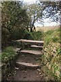
Stone Stile SW7242e
Outskirts of St Day, part way along footpath.
Cattle stile.
Public footpath 226/10/2 gold from Wheal Gorland Road to Pink Moors.
Image: © Lesley Trotter
Taken: 7 Apr 2021
0.09 miles
4
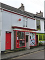
St. Day: the post office
The post office, in Fore Street, retains a traditional looking frontage and unlike many these days is not part of a general village store. There has been a post office in St. Day since 1830.
Image: © Chris Downer
Taken: 14 Oct 2013
0.11 miles
5
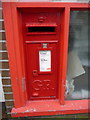
St. Day: postbox № TR16 62, Fore Street
The off-centre positioning of the collection plate is a giveaway that this postbox was designed for a post office frontage - and that is indeed the case, within the window of Image
Image: © Chris Downer
Taken: 14 Oct 2013
0.11 miles
6
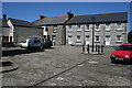
Market Square
This quiet courtyard behind the town clock used to be the bustling hub of St Day market in the time when this village was the commercial hub of the Gwennap mining district.
Image: © Tony Atkin
Taken: 7 Jun 2008
0.11 miles
7
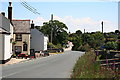
The Road into St Day
In the foreground is the Star Inn.
Image: © Tony Atkin
Taken: 7 Jun 2008
0.12 miles
8
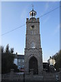
War Memorial Clock Tower
There is an OS cut mark on the granite wall of the Memorial Clock Tower. http://www.geograph.org.uk/photo/4450663
Image: © Adrian Dust
Taken: 20 Apr 2015
0.13 miles
9
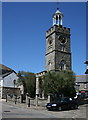
The Town Clock
This clock tower was built in 1831. It is capped by a distinctive bellcote which used to be on Redruth town clock and was erected here in 1904. The ground floor of the tower used to be used as a temporary lock-up to house the drunk and disorderly overnight.
Image: © Tony Atkin
Taken: 7 Jun 2008
0.13 miles
10
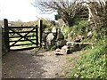
Stone Stile SW7242d
Wheal Gorland, St Day, part way along footpath.
Possible remains of a stile.
Public footpath 226/10/2 gold from Wheal Gorland Road to Pink Moors.
Image: © Lesley Trotter
Taken: 7 Apr 2021
0.13 miles