IMAGES TAKEN NEAR TO
Church Hill, REDRUTH, TR16 5LE
Introduction
This page details the photographs taken nearby to Church Hill, TR16 5LE by members of the Geograph project.
The Geograph project started in 2005 with the aim of publishing, organising and preserving representative images for every square kilometre of Great Britain, Ireland and the Isle of Man.

There are currently over 7.5m images from over14,400 individuals and you can help contribute to the project by visiting https://www.geograph.org.uk
Image Map
Images are licensed for reuse under creativecommons.org/licenses/by-sa/2.0
Notes
- Clicking on the map will re-center to the selected point.
- The higher the marker number, the further away the image location is from the centre of the postcode.
Image Listing (19 Images Found)
Images are licensed for reuse under creativecommons.org/licenses/by-sa/2.0
Image
Details
Distance
1
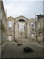
St Day old church - interior
This must truly have been a very impressive church in its heyday.
Image: © Rod Allday
Taken: 15 Apr 2008
0.05 miles
2
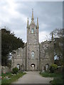
St Day old church
St Day nowadays is a pretty run-down village but the splendour of this (now derelict) church gives an indication of the town's great importance and wealth as a mining centre in the 18th & 19th centuries.
Image: © Rod Allday
Taken: 15 Apr 2008
0.06 miles
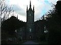
4
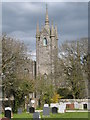
St Day old church
St Day nowadays is a pretty run-down village but the splendour of this (now derelict) church gives an indication of the town's great importance and wealth as a mining centre in the 18th & 19th centuries.
Image: © Rod Allday
Taken: 15 Apr 2008
0.06 miles
5
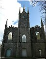
St Day - Old Church of All Saints - Western façade
A closer view of the western façade of the abandoned Old Church of All Saints in St Day seen in Image
Note that the white crucifix is in the southern (right) niche and the central niche contains a large door. Compare this with Peter Wood's photo taken in 2017 Image] where the crucifix is in the central (at that time, blocked) niche. This is also how it appears on the church's own website: https://www.stdayoldchurch.org
Image: © Rob Farrow
Taken: 3 Apr 2024
0.07 miles
7
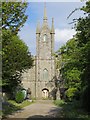
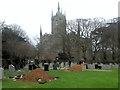
The Old Church at St Day
Viewed from the west.
Interesting information about the church can be found here : http://stday.org.uk/church-and-churchyard/
Image: © Peter Wood
Taken: 2 May 2017
0.07 miles
8
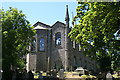
"It looks like an ecclesiastical toy fort"
The now roofless old Holy Trinity Church is more commonly known as St Day Old Church, although it is not really that old. The church was consecrated in 1828 having been built to meet the needs of the growing population of the town of St Day which was until then a part of Gwennap parish. In 1956 serious structural problems were discovered which led to the closure of the church. It was left to rot and vandalism which led to the eventual collapse of the roof. Conservation work began in 1999 and the interior of the church is now accessible and contains information plaques on the history of St Day. The quote used for the title is the poet Sir John Betjeman's take on this building.
Image: © Tony Atkin
Taken: 7 Jun 2008
0.07 miles