IMAGES TAKEN NEAR TO
North Country, REDRUTH, TR16 4AA
Introduction
This page details the photographs taken nearby to TR16 4AA by members of the Geograph project.
The Geograph project started in 2005 with the aim of publishing, organising and preserving representative images for every square kilometre of Great Britain, Ireland and the Isle of Man.

There are currently over 7.5m images from over14,400 individuals and you can help contribute to the project by visiting https://www.geograph.org.uk
Image Map
Images are licensed for reuse under creativecommons.org/licenses/by-sa/2.0
Notes
- Clicking on the map will re-center to the selected point.
- The higher the marker number, the further away the image location is from the centre of the postcode.
Image Listing (11 Images Found)
Images are licensed for reuse under creativecommons.org/licenses/by-sa/2.0
Image
Details
Distance
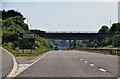
2
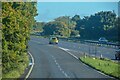
Redruth : The A30
A sliproad down onto the A30.
Image: © Lewis Clarke
Taken: 2 Oct 2022
0.14 miles
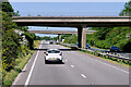
3
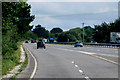
On to the A30
Joining the A30 near Redruth.
Image: © Robert Ashby
Taken: 18 Aug 2014
0.14 miles
4
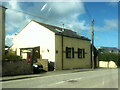
Former United Methodist Free church. North Country, Redruth
Built in 1864-5, now Chapel Cottage, a private dwelling.
Image: © Paul Barnett
Taken: 1 Jan 2016
0.15 miles
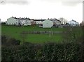
5
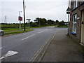
Redruth : Trenoweth Estate
Houses off Basset Road.
Image: © Lewis Clarke
Taken: 2 Oct 2022
0.16 miles

7
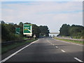
A30 Westbound Exit for Camborne West A3047
Image: © Roy Hughes
Taken: 4 Sep 2013
0.20 miles
8
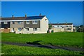
Housing Estate, North Country
Late 20th Century terraced housing.
Image: © Tony Atkin
Taken: 31 Dec 2005
0.20 miles
10
Carrick : The A30
The turn off towards Redruth or carry on to Land's End along the A30.
Image: © Lewis Clarke
Taken: 3 Jul 2011
0.21 miles