
IMAGES TAKEN NEAR TO
Kevill Road, REDRUTH, TR15 3FH
Introduction
This page details the photographs taken nearby to Kevill Road, TR15 3FH by members of the Geograph project.
The Geograph project started in 2005 with the aim of publishing, organising and preserving representative images for every square kilometre of Great Britain, Ireland and the Isle of Man.

There are currently over 7.5m images from over14,400 individuals and you can help contribute to the project by visiting https://www.geograph.org.uk
Image Map
Images are licensed for reuse under creativecommons.org/licenses/by-sa/2.0
Notes
- Clicking on the map will re-center to the selected point.
- The higher the marker number, the further away the image location is from the centre of the postcode.
Image Listing (22 Images Found)
Images are licensed for reuse under creativecommons.org/licenses/by-sa/2.0
Image
Details
Distance
1
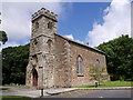
Trevenson Chapel
Built for the growing mining community at Pool, this is a chapel-of-ease to Illogan, whose parish church is over 2 kilometres to the north. A plaque on the entrance gateway states "built 1809 by Lord de Dunstanville and Basset". The windows are of interest, the tracery being made of iron, but require repair. More detail at http://www.saint-illogan.org.uk/trevenson.html .
Image: © Derek Harper
Taken: 22 Jun 2007
0.09 miles
2
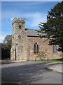
Trevenson Church
Built in 1809 by Lord de Dunstanville & Basset.
Image: © Rod Allday
Taken: 16 Oct 2008
0.09 miles
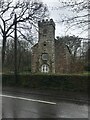
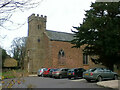
5
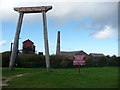
Cornish Mines & Engines Discovery Centre, Camborne
A large site incorporating engine house, museum and visitor centre, audio-visual displays and staffed by helpful assistants. Operated by the National Trust and in a process of being upgraded. The site is almost hidden behind a Morrison's supermarket.
Image: © Jeremy Bolwell
Taken: 6 Oct 2010
0.11 miles
7
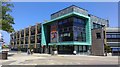
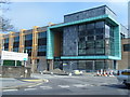
Pool Innovation Centre
The Innovation centre houses a number of small/medium sized local businesses. Built in 2010, it can be seen nearly completed in Image
Image: © Hywel Williams
Taken: 25 May 2017
0.13 miles
8
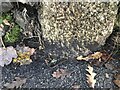
Benchmark bottom left of boundary stone on Agar Road, Pool
The drive to the left of this stone leads to a demolished church that is now new houses.
Image: © Ben Chmark
Taken: 26 Oct 2023
0.16 miles
9
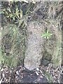
Old Boundary marker within wall beside Agar Road, Pool
Boundary Marker buried in wall on the Southern side of the road, outside ? Agar Road. Carn Brea parish. Inscribed B / 12. Thought to mark the boundary of a mine.
Milestone Society National ID:
Image: © Paul Barnett
Taken: 11 Feb 2023
0.17 miles
10
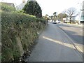
Old Boundary Marker on Trevenson Road, Pool
Mine Boundary Marker set in the stone front garden wall of No 27, on the south side of Trevenson Road, Pool. Carn Brea parish. Inscribed B / 12. Perhaps marking the boundary of South Crofty mine.
Milestone Society National ID: CW_CARNB06em
Image: © I Thompson
Taken: 5 Feb 2023
0.17 miles