IMAGES TAKEN NEAR TO
Barripper, CAMBORNE, TR14 0RE
Introduction
This page details the photographs taken nearby to TR14 0RE by members of the Geograph project.
The Geograph project started in 2005 with the aim of publishing, organising and preserving representative images for every square kilometre of Great Britain, Ireland and the Isle of Man.

There are currently over 7.5m images from over14,400 individuals and you can help contribute to the project by visiting https://www.geograph.org.uk
Image Map
Images are licensed for reuse under creativecommons.org/licenses/by-sa/2.0
Notes
- Clicking on the map will re-center to the selected point.
- The higher the marker number, the further away the image location is from the centre of the postcode.
Image Listing (8 Images Found)
Images are licensed for reuse under creativecommons.org/licenses/by-sa/2.0
Image
Details
Distance
1
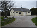
Barripper Village Hall
Next to the village sports ground.
Image: © Rod Allday
Taken: 4 Feb 2011
0.09 miles
2
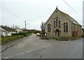
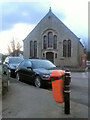
Methodist chapel at Barripper
UMFC over the door, but it is not a Methodist Free Church. It is part of the Camborne-Redruth Circuit of Methodist chapels. http://www.camborne-redruth.org/home/index.php/chapels/barripper
Image: © Humphrey Bolton
Taken: 26 Feb 2012
0.14 miles
3
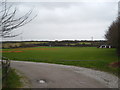
Barripper cricket field
Next to the village hall Image
Image: © Rod Allday
Taken: 4 Feb 2011
0.14 miles
5
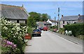
The Village of Barripper
The name Barripper is, unusually for Cornwall, derived from Norman French. It means 'beautiful retreat'.
Image: © Tony Atkin
Taken: 29 May 2006
0.14 miles
6
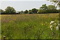
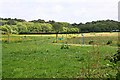
Wildflower meadow beside the Botetoe Road
I paused at a field gate in the Botetoe Road to look across this lovely meadow. The buildings are Brookfield Kennels and Cattery.
Image: © Elizabeth Scott
Taken: 25 May 2023
0.19 miles
7
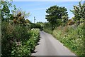
Colourful Hedgerows
This minor road south of the village of Barripper is enlivened by the profusion of Spring flowering plants on the hedgerows.
Image: © Tony Atkin
Taken: 29 May 2006
0.19 miles