
IMAGES TAKEN NEAR TO
Poltair Close, CAMBORNE, TR14 0FY
Introduction
This page details the photographs taken nearby to Poltair Close, TR14 0FY by members of the Geograph project.
The Geograph project started in 2005 with the aim of publishing, organising and preserving representative images for every square kilometre of Great Britain, Ireland and the Isle of Man.

There are currently over 7.5m images from over14,400 individuals and you can help contribute to the project by visiting https://www.geograph.org.uk
Image Map
Images are licensed for reuse under creativecommons.org/licenses/by-sa/2.0
Notes
- Clicking on the map will re-center to the selected point.
- The higher the marker number, the further away the image location is from the centre of the postcode.
Image Listing (9 Images Found)
Images are licensed for reuse under creativecommons.org/licenses/by-sa/2.0
Image
Details
Distance
1
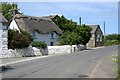
Thatched Cottage and Disused Methodist Church
The building beyond the cottage on the roadside was probably the church Sunday school, the church itself being set back from the road and hidden behind a tree on this photo. It is now houses a small industrial concern.
Image: © Tony Atkin
Taken: 29 May 2006
0.03 miles
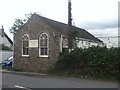
3
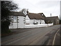
Thatched cottage and small barn at Barripper
Both listed http://www.imagesofengland.org.uk/Details/Default.aspx?id=66596&mode=adv & http://www.imagesofengland.org.uk/Details/Default.aspx?id=66597&mode=adv and both dating from the C18th. Next door is a former Methodist chapel converted to industrial use.
Image: © Rod Allday
Taken: 4 Feb 2011
0.06 miles
4

'School' sign on Baripper Road
Warning of the approach to Penponds School, which can be seen behind the trees. The warning lights on the sign are powered by solar energy from the photovoltaic cell which can be seen on top of the sign.
Image: © Rod Allday
Taken: 4 Feb 2011
0.10 miles
5
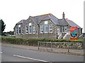
Penponds School
This local primary school occupies an old board school building built in 1910. It very obviously has a nice new roof.
Image: © Tony Atkin
Taken: 24 Sep 2005
0.15 miles
6
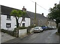
Church House, Penponds
Penponds Church Institute and Chapel House, listed Grade II. Church of England Infants School, now meeting rooms. Built in 1849. (National Heritage Listing)
Image: © Humphrey Bolton
Taken: 26 Feb 2012
0.22 miles
7
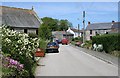
The Village of Barripper
The name Barripper is, unusually for Cornwall, derived from Norman French. It means 'beautiful retreat'.
Image: © Tony Atkin
Taken: 29 May 2006
0.23 miles
9
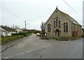
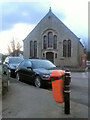
Methodist chapel at Barripper
UMFC over the door, but it is not a Methodist Free Church. It is part of the Camborne-Redruth Circuit of Methodist chapels. http://www.camborne-redruth.org/home/index.php/chapels/barripper
Image: © Humphrey Bolton
Taken: 26 Feb 2012
0.24 miles