
IMAGES TAKEN NEAR TO
St. Georges Road, TRURO, TR1 3JE
Introduction
This page details the photographs taken nearby to St. Georges Road, TR1 3JE by members of the Geograph project.
The Geograph project started in 2005 with the aim of publishing, organising and preserving representative images for every square kilometre of Great Britain, Ireland and the Isle of Man.

There are currently over 7.5m images from over14,400 individuals and you can help contribute to the project by visiting https://www.geograph.org.uk
Image Map
Images are licensed for reuse under creativecommons.org/licenses/by-sa/2.0
Notes
- Clicking on the map will re-center to the selected point.
- The higher the marker number, the further away the image location is from the centre of the postcode.
Image Listing (187 Images Found)
Images are licensed for reuse under creativecommons.org/licenses/by-sa/2.0
Image
Details
Distance
1
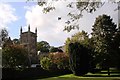
St George the Martyr, St George's Road, Truro
This small park near the Kenwyn viaduct looks attractive in the October sunshine.
Image: © Tom Jolliffe
Taken: 2 Oct 2008
0.00 miles
2
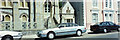
St George's Road Methodist south facade, Truro
This picture panoramically overlaps on the left with my photo of St George's Methodist with the viaduct, and on the right with my photo of St George's Road South. This is part of a four image composite panorama of the east side of St George's Road, Truro. Photographer at SW821449.
Image: © Elaine Hamby
Taken: Unknown
0.01 miles
3
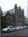
Former chapel on St George's Road, Truro
Most recently used as a school.
Image: © JThomas
Taken: 6 Nov 2014
0.01 miles
4
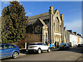
Former Methodist Chapel stands opposite to St. George's Church, and has more recently been used as a school
Image: © Paul Barnett
Taken: 23 Feb 2015
0.01 miles
5
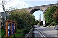
St George's Road, frontage of the Church ,Truro
Church of St George the Martyr is on the left out of the picture. The Kenwyn viaduct dominates this part of the road.
Image: © Tom Jolliffe
Taken: 2 Oct 2008
0.01 miles
6
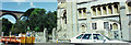
Truro Methodist Church St George's Road
The Methodist Church in Truro decided to close St Georges in December 1996, leaving only St Mary's to serve the city. This image panoramically overlaps its left side with my picture of the Viaduct to the north. Photographer at SW821449.
Image: © Elaine Hamby
Taken: Unknown
0.01 miles
7
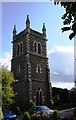
St George the Martyr church tower, Truro
Tower of St George the Martyr. This is an Anglican church - Grade 2 listed. It sits near the railway viaduct which traverses the valley in which Truro sits.
Image: © Tom Jolliffe
Taken: 2 Oct 2008
0.01 miles
8
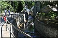
The River Kenwyn in Truro
The river here is running in a deep culvert.
Image: © Tony Atkin
Taken: 23 Jul 2006
0.02 miles

10

St George's Road, Truro
The Kenwyn Viaduct is in the next square, but the photograph was taken from this one with St George's Road in the foreground.
Image: © Tom Jolliffe
Taken: 2 Oct 2008
0.03 miles