
IMAGES TAKEN NEAR TO
Vicarage Road, HELSTON, TR13 9HP
Introduction
This page details the photographs taken nearby to Vicarage Road, TR13 9HP by members of the Geograph project.
The Geograph project started in 2005 with the aim of publishing, organising and preserving representative images for every square kilometre of Great Britain, Ireland and the Isle of Man.

There are currently over 7.5m images from over14,400 individuals and you can help contribute to the project by visiting https://www.geograph.org.uk
Image Map
Images are licensed for reuse under creativecommons.org/licenses/by-sa/2.0
Notes
- Clicking on the map will re-center to the selected point.
- The higher the marker number, the further away the image location is from the centre of the postcode.
Image Listing (123 Images Found)
Images are licensed for reuse under creativecommons.org/licenses/by-sa/2.0
Image
Details
Distance
1
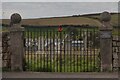
Cemetery gates
Entrance to the cemetery from Vicarage Road. The gates commemorate those who died in WWI. See also Image and Image
Image: © Elizabeth Scott
Taken: 11 Sep 2023
0.02 miles
2
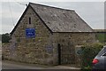
Private chapel of rest
Image: © Elizabeth Scott
Taken: 11 Sep 2023
0.03 miles
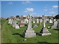
4
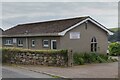
Undertaking business in Vicarage Road
This funeral services business is in Vicarage Road adjacent to the cemetery. See also Image and Image
Image: © Elizabeth Scott
Taken: 11 Sep 2023
0.04 miles
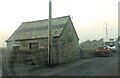
6
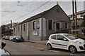
Porthleven Public Hall
Public Hall and Women's Institute.
Image: © Elizabeth Scott
Taken: 11 Sep 2023
0.08 miles
7
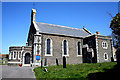
Porthleven: St. Bartholomew's Church
Image: © Dr Neil Clifton
Taken: 22 Apr 2010
0.08 miles
8
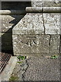
OS benchmark & bolt - Porthleven, St Bartholomew's Church
A primary levelling bolt and cutmark on the buttress of St Bart's; originally levelled between August 1849 and November 1850 at 39ft 4in above Ordnance Datum Liverpool.
Image: © Richard Law
Taken: 15 Oct 2015
0.09 miles
9
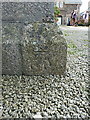
OS benchmark - Porthleven, Methodist Church
AN OS cutmark low on the wall of the Methodist Church on Fore Street; originally levelled in 1972 at 14.149m above Ordnance Datum Newlyn.
Image: © Richard Law
Taken: 15 Oct 2015
0.10 miles
10
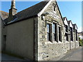
Porthleven's former National School
Now displaying a sign that says it's the Christadelphian Hall, but a stone set into the wall on the far side gives the game away - it was originally the National School, built in the early 1840s.
Image: © Richard Law
Taken: 15 Oct 2015
0.10 miles