
IMAGES TAKEN NEAR TO
Park Close, HELSTON, TR13 0AW
Introduction
This page details the photographs taken nearby to Park Close, TR13 0AW by members of the Geograph project.
The Geograph project started in 2005 with the aim of publishing, organising and preserving representative images for every square kilometre of Great Britain, Ireland and the Isle of Man.

There are currently over 7.5m images from over14,400 individuals and you can help contribute to the project by visiting https://www.geograph.org.uk
Image Map
Images are licensed for reuse under creativecommons.org/licenses/by-sa/2.0
Notes
- Clicking on the map will re-center to the selected point.
- The higher the marker number, the further away the image location is from the centre of the postcode.
Image Listing (10 Images Found)
Images are licensed for reuse under creativecommons.org/licenses/by-sa/2.0
Image
Details
Distance
1
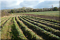
Farmland, Crowan
A field of daffodils at Nancegollan with a footpath following its edge towards the B3303.
Image: © Andrew Smith
Taken: 8 Jan 2023
0.14 miles
2
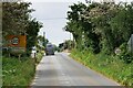
Nancegollan
Nancegollan (Cornish: Nansigolen) is a village on the B3303 road between Camborne and Helston.
Image: © David Dixon
Taken: 6 Jun 2023
0.14 miles
5
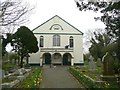
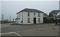
Nancegollan Village Hall
The village hall is in the former church, dated 1859.
Image: © Humphrey Bolton
Taken: 2 Mar 2012
0.18 miles
6
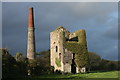
Nancegollan Mine
This engine house is a Grade 2 listed building, listed as "Nancegollan Mine or Florence United Tin Mine". It was a showery day and I was lucky to catch a burst of sun on the engine house and chimney.
Image: © Elizabeth Scott
Taken: 23 Oct 2010
0.19 miles
7
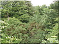
Where the railway ran
Where the railway ran at Nancegollan (and I think where the old station was). The object on the left is possibly an old lamppost from the station platform.
Image: © Sheila Russell
Taken: 27 Jun 2006
0.20 miles
8
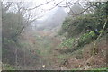
Old railway cutting at Nancegollan
On the old Helston branch line, which was closed in the 1960s as part of the Beeching cuts. Through the mist can just be seen the road bridge to the south.
Image: © Rod Allday
Taken: 30 Mar 2011
0.22 miles
9
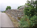
Old railway bridge
Bridge over disused railway at Nancegollan, looking west.
Image: © Sheila Russell
Taken: 27 Jun 2006
0.22 miles
10
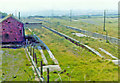
Site/remains of Nancegollan station, 1973
View southward, towards Helston: ex-GWR Gwinear Road - Helston branch, closed to passengers 5/11/62, to goods 5/10/64. [With apologies for poor quality of slide].
Image: © Ben Brooksbank
Taken: 8 Sep 1973
0.24 miles