
IMAGES TAKEN NEAR TO
Woodcourt Road, TOTNES, TQ9 7TY
Introduction
This page details the photographs taken nearby to Woodcourt Road, TQ9 7TY by members of the Geograph project.
The Geograph project started in 2005 with the aim of publishing, organising and preserving representative images for every square kilometre of Great Britain, Ireland and the Isle of Man.

There are currently over 7.5m images from over14,400 individuals and you can help contribute to the project by visiting https://www.geograph.org.uk
Image Map
Images are licensed for reuse under creativecommons.org/licenses/by-sa/2.0
Notes
- Clicking on the map will re-center to the selected point.
- The higher the marker number, the further away the image location is from the centre of the postcode.
Image Listing (55 Images Found)
Images are licensed for reuse under creativecommons.org/licenses/by-sa/2.0
Image
Details
Distance
1
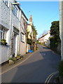
Morleigh road, Harbertonford
Cottages line this steep hill in the south-west part of the village.
Image: © Derek Harper
Taken: 29 Apr 2006
0.05 miles
2
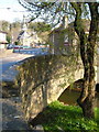
Harbertonford
The bridge over the River Harbourne, with the Victorian church and the Maltsters Arms on either side of the A381. The river bed beneath the bridge was considerably deepened a few years ago as part of a major flood defence scheme (sandbags used to be a frequent sight in neighbouring streets) after it was discovered that the bridge itself was a bottleneck for the river. https://restorerivers.eu/wiki/index.php?title=Case_study%3AHarbertonford_Flood_Alleviation_Scheme : "Channel lowered by 600mm through Harbertonford using pool-riffle sequences, to increase channel capacity, to withstand 28 cumec flow (1:10 year event). Also widened in areas to further increase capacity."
Image: © Derek Harper
Taken: 29 Apr 2006
0.05 miles
3
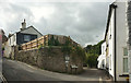
Junction, Harbertonford
The through lane, for Boreston and Moreleigh, climbs left here; the right turn along Woodcourt Road is a public access route to the farm of that name.
Image: © Derek Harper
Taken: 12 Aug 2018
0.07 miles
4
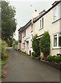
Hernaford Lane, Harbertonford
A cul-de-sac for vehicles off Old Road, though as a route with public access it reaches the farm and lane at Hernaford.
Image: © Derek Harper
Taken: 12 Aug 2018
0.08 miles
5
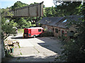
Yard with red van, Harbertonford
Premises of Fine Pine, whose business is "antique pine furniture", to quote the sign at the entrance. The canopy, upper left, extends from the adjoining building.
Image: © Robin Stott
Taken: 29 Jul 2010
0.08 miles
6
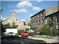
Old Mill, Harbertonford
Yet to benefit from an imaginative redevelopment.
Image: © Robin Stott
Taken: 29 Jul 2010
0.09 miles
7
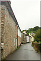
Woodland Road, Harbertonford
This becomes the lane up the Harbourne River valley to Rolster Bridge.
Image: © Derek Harper
Taken: 12 Aug 2018
0.10 miles
8

Church of St Peter, Harbertonford
Grade II listed. http://www.britishlistedbuildings.co.uk/en-101335-church-of-st-peter-harberton
Image: © N Chadwick
Taken: 8 Jun 2012
0.10 miles
10
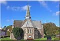
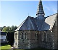
St Peter's Church, Harbertonford
The Church in the village of Harbertonford.
Image: © Wayland Smith
Taken: 4 Oct 2014
0.11 miles