Harbertonford
Introduction
The photograph on this page of Harbertonford by Derek Harper as part of the Geograph project.
The Geograph project started in 2005 with the aim of publishing, organising and preserving representative images for every square kilometre of Great Britain, Ireland and the Isle of Man.

There are currently over 7.5m images from over 14,400 individuals and you can help contribute to the project by visiting https://www.geograph.org.uk
Harbertonford
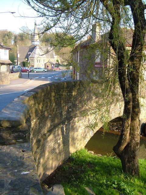
Image: © Derek Harper Taken: 29 Apr 2006
The bridge over the River Harbourne, with the Victorian church and the Maltsters Arms on either side of the A381. The river bed beneath the bridge was considerably deepened a few years ago as part of a major flood defence scheme (sandbags used to be a frequent sight in neighbouring streets) after it was discovered that the bridge itself was a bottleneck for the river. https://restorerivers.eu/wiki/index.php?title=Case_study%3AHarbertonford_Flood_Alleviation_Scheme : "Channel lowered by 600mm through Harbertonford using pool-riffle sequences, to increase channel capacity, to withstand 28 cumec flow (1:10 year event). Also widened in areas to further increase capacity."
Images are licensed for reuse under creativecommons.org/licenses/by-sa/2.0
Image Location
Latitude
50.392151
Longitude
-3.713447