IMAGES TAKEN NEAR TO
Harbertonford, TOTNES, TQ9 7SZ

Introduction

This page details the photographs taken nearby to TQ9 7SZ by members of the Geograph project.

The Geograph project started in 2005 with the aim of publishing, organising and preserving representative images for every square kilometre of Great Britain, Ireland and the Isle of Man.

There are currently over 7.5m images from over14,400 individuals and you can help contribute to the project by visiting https://www.geograph.org.uk

Image Map


Images are licensed for reuse under creativecommons.org/licenses/by-sa/2.0
Notes
  • Clicking on the map will re-center to the selected point.
  • The higher the marker number, the further away the image location is from the centre of the postcode.

Image Listing (55 Images Found)

Images are licensed for reuse under creativecommons.org/licenses/by-sa/2.0
  • ...
Image
Details
Distance
1
Harbourne filling station Harbertonford
Image: © Roy Hughes Taken: 6 Aug 2022
0.01 miles
2
Filling Station, Harbertonford
Image: © N Chadwick Taken: 24 Oct 2016
0.02 miles
3
School entrance, Old Road, Harbertonford
This is the Harbertonford C. of E. (V.A.) Primary School.
Image: © Robin Stott Taken: 29 Jul 2010
0.02 miles
4
A381 passing St Peter's Church
A381 passing St Peter's church in the centre of Harbertonford
Image: © Shaun Ferguson Taken: 18 Aug 2010
0.03 miles
5
Harberton Stream channel, Harbertonford
Brooks and springs north of the village feed the Harberton Stream. It is culverted under the busy A381 to join the Harbourne River by the village green Image This walled corridor between the churchyard and the road appears to be shared by the stream and a grass footpath. More context in Image Details of the 2003 Harbertonford Flood Defence Scheme are linked from Image
Image: © Robin Stott Taken: 29 Jul 2010
0.03 miles
6
War Memorial, Harbertonford
In St Peter's churchyard.
Image: © Robin Stott Taken: 29 Jul 2010
0.04 miles
7
St Peter's church, Harbertonford
Image: © Roy Hughes Taken: 6 Aug 2022
0.04 miles
8
Harberton Stream channel, Harbertonford
See Image; this view show a little more foreground, with paving.
Image: © Derek Harper Taken: 12 Aug 2018
0.05 miles
9
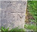
Ordnance Survey Cut Mark
This OS cut mark can be found on the SE face of St Peter's Church. It marks a point 33.778m above mean sea level.
Image: © Adrian Dust Taken: 29 Mar 2019
0.05 miles
10
Church of St Peter, Harbertonford
The cruciform church, built in 1860, is described at http://list.historicengland.org.uk/resultsingle.aspx?uid=1108232&searchtype=mapsearch .
Image: © Derek Harper Taken: 28 Aug 2015
0.05 miles
  • ...