
IMAGES TAKEN NEAR TO
Tuckenhay, TOTNES, TQ9 7EQ
Introduction
This page details the photographs taken nearby to TQ9 7EQ by members of the Geograph project.
The Geograph project started in 2005 with the aim of publishing, organising and preserving representative images for every square kilometre of Great Britain, Ireland and the Isle of Man.

There are currently over 7.5m images from over14,400 individuals and you can help contribute to the project by visiting https://www.geograph.org.uk
Image Map
Images are licensed for reuse under creativecommons.org/licenses/by-sa/2.0
Notes
- Clicking on the map will re-center to the selected point.
- The higher the marker number, the further away the image location is from the centre of the postcode.
Image Listing (45 Images Found)
Images are licensed for reuse under creativecommons.org/licenses/by-sa/2.0
Image
Details
Distance
1
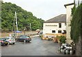
Riverside at the Maltster's Arms
The pub on the right is shown from the road in Image and Image It has riverside tables, ideal on sunnier days than this - though there is a brief glimmer of sun here. Across Bow Creek is Crownley Wood.
Image: © Derek Harper
Taken: 24 Jul 2016
0.01 miles
2
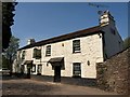
Maltster's Arms, Tuckenhay
Best known for the seven-year ownership of TV's Keith Floyd, but long a waterside pub favourite - the creek is on the other side. The C19 building is listed http://www.britishlistedbuildings.co.uk/en-100961-maltster-s-arms-public-house-ashprington .
Image: © Derek Harper
Taken: 20 Apr 2011
0.01 miles
3
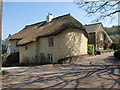
Quay Cottage, Tuckenhay
"Probably mid C17, divided into 2 or 3 cottages in the C19 and reunited in the C20" http://www.britishlistedbuildings.co.uk/en-100963-quay-cottage-ashprington . The cottage has been rethatched since the description was written. By Stable Cottage, on the right, the lane swings right up Tuckenhay Creek.
Image: © Derek Harper
Taken: 20 Apr 2011
0.05 miles
4

Bow Creek
A boat and pontoon at the Maltster's Arms.
Image: © Derek Harper
Taken: 24 Jul 2016
0.06 miles
5
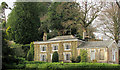
Tuckenhay House
"Dated 1799, remodelled and extended in circa 1840" https://historicengland.org.uk/listing/the-list/list-entry/1108368 ; this extension involved the single-storey wing on the right. "Tuckenhay House is said to have been the manager's house of Tuckenhay Paper Mill". Seen from the Dart Valley Trail / John Musgrave Heritage Trail across the creek.
Image: © Derek Harper
Taken: 5 Dec 2019
0.06 miles
6
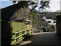
Lane through Tuckenhay
Followed by the Dart Valley Trail and the John Musgrave Heritage Trail. The building on the left is described at http://list.english-heritage.org.uk/resultsingle.aspx?uid=1291685&searchtype=mapsearch .
Image: © Derek Harper
Taken: 17 Feb 2015
0.08 miles
7
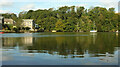
Bow Creek
Looking right from Image] to where the creek of the River Wash meets Bow Creek, with Crownley Wood on the far bank.
Image: © Derek Harper
Taken: 12 Oct 2021
0.08 miles
8
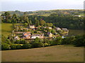
Tuckenhay
Seen from the footpath on Corkscrew Hill, across Washbourne Creek as it enters Bow Creek (right). Tuckenhay House is centre right, Springfield House top left. A scene of deceptive rural charm, as Tuckenhay was formerly a thriving, if small, industrial centre.
Image: © Derek Harper
Taken: 23 Jun 2006
0.08 miles
9
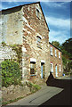
Ashprington: Tuckenhay mill
An overshot waterwheel, out-of-shot, foreground, was in situ in 1994. Near Tuckenhay Paper Mill, but powered by a separate leat on the other side of the valley. This was a grain mill
Image: © Martin Bodman
Taken: Unknown
0.08 miles
10
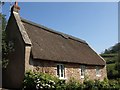
Riverside, Tuckenhay
A thatched house that incorporates a former warehouse; its development is discussed at http://www.britishlistedbuildings.co.uk/en-100966-riverside-ashprington . It sits at right angles between the lane and the creek.
Image: © Derek Harper
Taken: 20 Apr 2011
0.09 miles