IMAGES TAKEN NEAR TO
Staverton, TOTNES, TQ9 6AN
Introduction
This page details the photographs taken nearby to TQ9 6AN by members of the Geograph project.
The Geograph project started in 2005 with the aim of publishing, organising and preserving representative images for every square kilometre of Great Britain, Ireland and the Isle of Man.

There are currently over 7.5m images from over14,400 individuals and you can help contribute to the project by visiting https://www.geograph.org.uk
Image Map
Images are licensed for reuse under creativecommons.org/licenses/by-sa/2.0
Notes
- Clicking on the map will re-center to the selected point.
- The higher the marker number, the further away the image location is from the centre of the postcode.
Image Listing (28 Images Found)
Images are licensed for reuse under creativecommons.org/licenses/by-sa/2.0
Image
Details
Distance
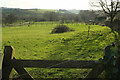
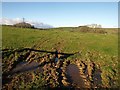
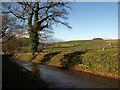
2
Oak, pylon, grain dryer, barn
A good set beside Staverton Footpath 11 as it approaches the lane between Staverton and Wash Cross.
Image: © Derek Harper
Taken: 5 Dec 2008
0.05 miles
3
Near Barkingdon Manor
Looking from Staverton Footpath 11 towards the valley of the stream mentioned in Image Beyond is Barton Hill, rising through Image into Image
Image: © Derek Harper
Taken: 5 Dec 2008
0.06 miles
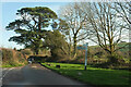
4
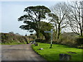
Signpost and road junction, Barkingdon
Image: © Ruth Sharville
Taken: 11 Jan 2015
0.07 miles
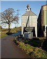
5
Field near Barkingdon Manor
With one of the pylons that are fairly ubiquitous around here, and Tor Hill Plantation behind it. The more distant hilltop wood is Penn Plantation, in Image
Image: © Derek Harper
Taken: 5 Dec 2008
0.08 miles
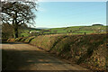
6
Junction, Barkingdon
The signpost is labelled simply "Barkingdon" rather than "Barkingdon Cross".
Image: © Derek Harper
Taken: 21 Jan 2020
0.08 miles
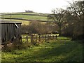
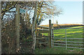
7
Bank by lane at Barkingdon
Image: © Derek Harper
Taken: 21 Jan 2020
0.08 miles
8
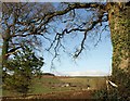
Trees frame the view
From Staverton Footpath 11 near Barkingdon Manor. Trees along the lane between Staverton and Wash Cross frame this distant view of Tidwell, in Image, and Penn Plantation (in Image). Where is that waymarking directing me?
Image: © Derek Harper
Taken: 5 Dec 2008
0.08 miles
9
Lane near Barkingdon Manor
From its junction with Staverton Footpath 11, looking down the lane in the direction of Wash Cross. Penn Plantation in the distance.
Image: © Derek Harper
Taken: 5 Dec 2008
0.08 miles
10
Footpath, Barkingdon
Staverton footpath 4 heads towards Woolston Green, from a bend in the lane to Memory Cross.
Image: © Derek Harper
Taken: 21 Jan 2020
0.10 miles