1
Totnes
Totnes has many fine Elizabethan buildings. It has a higher percentage of listed buildings than any other town in Britain.
Image: © Val Vannet
Taken: 10 Jul 2004
0.01 miles
2
St. Mary's church, Totnes
St Mary's church was built in the 15th century and extended in the 19th, but the site is thought to have been a centre of worship for over a thousand years. The ornate stone screen is part of the original 15th century building and is regarded as a very fine example.
Image: © Laura Whiting
Taken: 14 Apr 2005
0.01 miles
3
Butterwalk, High street, Totnes
One of two covered pavement arcades in Totnes with stone pillars carrying the overhanging storeys of the houses. These walkways once sheltered markets.
Image: © Laura Whiting
Taken: 14 Apr 2005
0.01 miles
4
The Narrows, Totnes
..aptly called "The Narrows" as it's less than 15 feet wide, including the pavements, also showing the Norman motte-and-bailey castle in the centre.
Image: © Laura Whiting
Taken: 6 Apr 2005
0.01 miles
5
Elizabethan Charity Market, Totnes
Every Tuesday Morning from May to September, Totnes Elizabethan Society holds a charity market in the square outside the Civic Hall. Some stallholders wear Elizabethan costume - as demonstrated by the young lady who was one of the dancers entertaining the large crowd
Image: © Neil Kennedy
Taken: 10 Aug 2004
0.01 miles
6
Totnes, A Car on the River Dart
I'm not sure if James Bond was at the wheel, I couldn't quite see the driver's face!
Image: © Neil Kennedy
Taken: 12 Aug 2004
0.01 miles
7
Totnes, A Sunset
Taken from the bridge over the river.
Image: © Neil Kennedy
Taken: 12 Aug 2004
0.01 miles
8
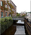
Mill leat, Totnes
The leat for the Town Mills becomes tidal beyond a sluice at the next bridge. On the right, buses wait in the layby on Coronation Road.
Image: © Derek Harper
Taken: 19 Sep 2009
0.03 miles
9
Footbridge over Mill Leat, Totnes
The footbridge connects Stags offices in The Granary http://www.geograph.org.uk/photo/4059801 with Coronation Road.
Image: © Jaggery
Taken: 5 Jul 2014
0.03 miles
10
Reflected estate agents, Totnes
"Probably a canal warehouse" https://www.historicengland.org.uk/listing/the-list/list-entry/1264284 ; definitely associated with the Harris bacon factory that used to occupy this part of town. It is reflected in a mill leat beside Coronation Road.
Image: © Derek Harper
Taken: 11 Apr 2017
0.03 miles


